When I realized I was only going to be able to go on one TNAB trip for the final month of the season I set up another TuNAB. It was ostensibly to be a scouting mission for next season to help provide diversity of routes for the group.
After the last TuNAB on Denny Mountain turned into a nasty bushwhack in the dark (albeit well worth it for the upper portions of the mountain) I should have known better. Still, I had a group of hardy adventurers to accompany me.
Or at least I did until a few days before we were set to go. They all had good excuses, mind you. Some were working late, some had just returned from an epic week-long trip with enough elevation gain to top Everest, and some were about to set off on a trip to bag a couple of 14ers in Colorado. So when Tuesday night came it was just me, Tokul, and Matt meeting at TruckTown.
The destination was Cave Ridge at Snoqualmie Pass. The high point sits between Guye Peak (2006, 2008, 2009) and Snoqualmie Mountain (2008, 2009), but I'd only been there once during the winter. The five trips to Cave Ridge's neighbors all started from the Alpental parking lot and even though there's a pretty obvious trail heading toward Cave Ridge from the saddle between it and Guye Peak I've never explored it.
So this trip would be: (a) mostly in the dark, (b) mostly in the pouring rain, (c) mostly on new trails (because we were heading up from the opposite side out of Commonwealth Basin), and (d) isn't that enough?
The windshield wipers worked just well enough we avoided a catastrophe on the road and got to the (not surprisingly) deserted trailhead. Matt and I were sealed in Gore-Tex as we hoofed it up the Commonwealth Basin trail that also provides access to Red Mountain and Kendall Peak for TNAB. I remained mostly dry except for the sweat that comes with being encased in breathable, but not quite that breathable gear.
We crossed the creek and continued up the trail, looking for a path to the left that would take us to the saddle. The trail doesn't show on any maps I could find so I'd done like last time and figured the trail probably followed a gully up. Pick one at random and up we went. Good planning, huh?
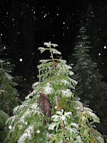
We bushwhacked up a little ridge, but didn't find a trail. We pushed on, sidehilling and traversing, but didn't find a trail. We descended into a little swamp, but... didn't find a trail. Needless to say, we weren't finding a trail. And it was starting to snow. (Remember "(b) mostly in the pouring rain" from above? If it wasn't pouring rain it was pounding snow.)
We set an early turnaround time of 7:15 given we didn't have a good route out and it would be 100% dark and joked that we'd find the trail at exactly 7:14. Guess what happened? Yeah, we found the trail a couple hundred feet below the saddle at about 7:10. We continued up and readched the saddle at about 7:20pm. We decided against continuing to the summit since we had no idea how the trail down would be and instead hung out on a rocky knob that offered no views (thanks to the storm), but that was completely exposed to the snow and wind (thanks to the storm).
Needless to say, we didn't stay long. (Though I did send my first "it's all good, we're heading down" message to Amy from my iPhone.) We paid special attention to the route down because this was the reason we were here. Following the sometimes sketchy path, especially where there were trees down or it crossed rocks was a little difficult, but Tokul took the lead and almost always found the right way. We were in snow down to about 4,000 feet, though Matt, a meteorologist by trade, assured me this would melt off in a few days.
It turns out my stab at the route was totally wrong. Rather than following one of the creeks down the trail hugged the flank of Guye Peak trending more to the south than the east. When we finally got back to Commowealth Basin we lost the trail because it seemed to turn back the wrong way. Just a few feet down that "wrong way" was an intersection with the trail we'd followed upstream right at the creek crossing. (We'd even joked about how that was likely the trail we wanted when we passed it the first time.)
It was about 45 minutes down and just another 15 minutes back to the car, which had miraculously not floated away.
Although we'd had some difficulty following the path on the way down it'd be a lot easier on the way up in daylight and after having followed it up wouldn't be at all a problem to descend. However, as a descent-only route it was a bit dicey (especially in the dark) and so dreams of a loop that comes down through the Commonwealth Basin are probably shot. Otherwise it will probably be a great addition to the TNAB schedule or perhaps as an alternate way up Guye Peak.
Total distance was about four miles and 2,000 feet of gain.