At the end of June TNAB had targeted Abiel Peak south of Snoqualmie Pass with playful thoughts of doing the easy scramble up Silver Peak as well. I went one better and completed the trifecta of Abiel, Silver, and Tinkham Peaks.
On Tinkham Peak we had used the boot path (not an official trail) up to the west peak and then crossed the easy ridge to the east peak. When I heard TNAB was heading back to Tinkham to complete the trio I convinced the organizer to tackle Tinkham from the east (actually southeast) so I wouldn't be covering the same ground.
The drive to the "trailhead" was mostly painless. It's along the same route as to Mirror Lake, but a less-traveled and unmaintained road drops off before getting to the Mirror Lake trailhead. Although the Mirror Lake (and Cottonwood Lake, too, to be accurate) trailhead is an official one the route we were taking began where the road was too overgrown to continue by car. We were about a quarter mile south of Mirror Lake, right by the outlet stream.
I was the first one there, but figured I'd get a head start by myself. Surely the others would catch me up. I started up the road expecting to cross the PCT and use that to gain the lake. However, I must have driven across the trail without noticing and was too far to the west. Realizing I was going away from Mirror Lake instead of toward it I picked what looked like a decent line and dove into the brush.
Much bashing and many blueberries later I found a dirty talus field and used that to ascend to a spot where I could see the lack of trees to the east that was Mirror Lake. I left the talus and headed that way. I found a couple of ribbons, but they didn't seem to go where I thought I would need to go so I continued off-trail.
It turned out I was about 50 or 100 feet above the lake. Since Tinkham Peak towered above me I figured I'd catch the trail when I crossed it as long as I stayed high. Good plan, John. The slope got steeper and brushier pushing me down toward the lake. I never got all the way down, but did eventually wind up near the base of a talus field at the north end of the lake.
This area had an alpine field so I was happy to climb. I swore I heard voices (and probably did) and kept looking down toward the lake as I climbed expecting to see the rest of the group. I even shouted out the traditional TNAB greeting (hoo-ah!), but got no response.
At the top of the talus I was confronted with a sheer drop to the north and rocks to the west. Huh. So I scrambled up the rocks only to be again confronted by a sheer drop and unclimbable (for me anyway) rocks to the west. Great.
I gave up some of my elevation to skirt the rocks on their south side until I found a berry bush filled gully that looked like it would take me to the ridge connecting the two summits. It wouldn't have been bad climb had the blueberries not been all dried out and the thimbleberries too sweet. However, lacking tastiness the climb was uninspiring. At the top of the gully I found myself not at the ridge, but facing more cliffs.
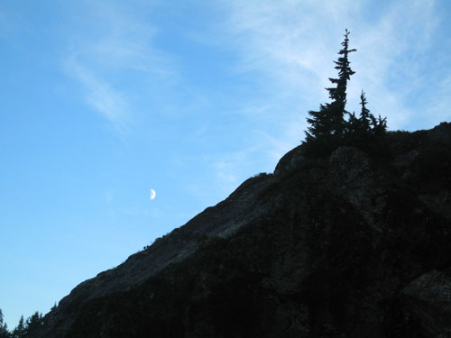
The moon was now well up and the light was fading quickly. Looking to the west I could see another possible route up, but that would be my last attempt lest I wind up in the dark with no good way down except the way I'd come up. I dropped a couple hundred feet and started up through the thick scrub trees and popped onto combination of talus and scree. It wasn't the ridge I thought, but it did look feasible, especially when I saw the cairn marking the trail.
Once on top of the east peak I looked to the west peak for signs of TNAB folks standing there, but saw nothing against the red sky. I gave my best hoo-ah and was greeted by a surprisingly close response. The whole TNAB crew was returning from their walk to the west summit. I felt relief that I wouldn't be heading down in the dark on an unfamiliar trail by myself.
In addition to getting out for a hike I was here to place Ed Miller's Traveling Summit Register Memorial that I had retrieved from Big Snow Mountain a few weeks ago. I considered placing it on the east peak, but truly it belonged on the west peak because, in the words of one of the other TNAB hikers, the west peak was "five feet higher."
So while they headed down I headed west. It had taken an hour and forty minutes to get up to the east peak (it should have been something closer to an hour), but only another 10 minutes to the west peak. I signed the summit register there and made a note in Ed's register, too. I released a pinch of Ed's ashes and sealed up the tube tightly before donning my headlamp and heading back to the east peak.
I would have liked to put Ed's register somewhere more rugged or remote or worthy of the kinds of trips he used to make, but Tinkham was the best I was going to have on my calendar for a while. He had already spent almost two weeks on the island in the South Fork behind the house and it was time for him to get back on high.
(I had only retrieved the register from the island on Wednesday morning when I panicked and thought the light rain was going to raise the river enough to take the small tube downstream. My poor neighbor was more than a little concerned by the headlamp racing up the creek and brush in the rain at 5am until he saw it was just crazy me. Needless to say, the river hadn't budged and the register was still secure.)
The trip down was full of finding the trail and losing it again. It's only a relatively obscure boot path and by the light of the headlamp it would disappear and then reappear only to not really be the trail and then be the trail again. I had a few moments of panic when I figured I'd be bashing through brush blindly to the lake, but then I came across two things I generally hate to see in the woods: flagging and "no tresspassing" signs. The trail is pretty well marked with ribbons and even when you lose the ribbons you can just stay to the east of the Cedar River Watershed signs that are posted on each and every tree along the route. (And if I got lost in the watershed they'd find me right quick and I'd only have to spend a few days in jail as payment for my "rescue.")
The trail popped out onto a dirty talus slope that even in the dark I could tell was the slope I had started my trip on. Dang. And those ribbons I thought led nowhere? They were the beginning of the trail.
Total distance was 2.71 miles and 1,827 feet of gain in two hours and 40 minutes. Of course, I should bump that up by 77 feet and I'd have 14,000 feet of gain for the month so, yeah... make that 1,904 feet of gain.