At 5:08am Amy's foot in my back convinced me that getting up was the least of my worries so I stumbled into the bathroom. By 6am I was on the road with Tokul my only companion. My usual accomplices in stupidity had all shown they were far more reasonable and had declined my invitation.
The sun was already flooding the hills, but the South Fork valley all the way up to the Pass was cloaked in shadows. Not a cloud to be seen. By the time I got to Easton the caffeine was starting to kick in and after only one missed turn (the final turn onto the Forest Service road) I was at the trailhead. An hour and 10 minutes over two passes and through some wicked mud holes.
This hike was altered from my original intent thanks to a warning from a fellow online hiker. He had done a similar trip earlier and heard the roads I originally planned to follow were closed due to mud. The shorter, better road I took still had some nasty wallows, but nothing a freshly washed truck couldn't handle. (Yeah, I'd pay for that later.)
Tokul and I were quickly huffing our way up the Tronson Meadow trail in the cool morning air. The trail is open to motorcycles from June 15 - (some time in the Fall) and it shows. It's got a nasty rut down the middle and is generally burned out. We crossed a few small trickles of water that Tokul sampled, but I had five liters of water with us in case we found nothing else.
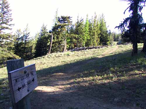
A mile and a half in and 1,100 feet of gain we intersected the Mt. Lillian loop trail. After the agressive elevation gain of the Tronson Meadow trail the sedate slope of the Mt. Lillian trail, winding up through a sage meadow, was quite nice. We crossed a road and entered the peculiar east slope forest that's so different than the lush west side woods I'm used to. Much more open and airy and really quite nice.
The trail continues with minor undulations until it reaches the Upper Naneum Meadows where Naneum Creek was flowing pretty well. Tokul took a quick swim and we continued upstream before crossing again.
The trail from Tronson to the crossing was pretty good. No ruts, fairly small. We crossed another road that looked pretty well used and the trail degraded quickly. A big rut runs down the middle and it's wide enough that three or four people could walk abreast.
A short ways in a faint trail heads up to the left. I could see daylight at the top of the rise and headed that way for a peek.
HOLY COW!
The trail ended at the end of a massive cliff. From where I stood the cliff extended to the north maybe a quarter mile. The trees came right to the edge, but beyond the trees solid rock dropped hundreds of feet. At the bottom the rock was channeled as though some massive river had cut through it, but there didn't seem to be any water source around.
The trail followed the cliff edge toward the summit so I headed that way. Tokul enjoyed going right to the edge, making my heart stop, then looking back as if to say, "nyah nyah." We danced with death (not really) by going out on a finger of stone to get better pictures, but quickly retreated after shooting a few.
The trail dipped back into the woods where I saw the last few square feet of snow for miles around, then came out on the corner of Mt. Lillian. The summit itself is hidden in the trees and there's nothing really to see. Off the corner, though, are some monoliths that stand guard. The valley drops away while the trail stays on the upper edge.
This is where technology failed me.
The trail clearly continued on and I saw no other trails. The GPS showed I was off the trail by an increasing margin. No problem. I just go this way back toward the summit. No... now I'm farther from the trail. Maybe over here... I had done a circle and was back on the first trail. Dang. (In the middle of my circle I walked over the actual summit and spooked an unseen, but very loud, elk. Tokul went on leash.)
I continued down the trail after staring at the GPS screen, the map, and my compass. At the time I figured there must be a trail down in the valley that I was supposed to be on and this trail was an unmarked trail. Yeah, right.
In retrospect, I was on the right trail all along, but let my faith in the GPS mislead me. Sucker.
So, believing I was on the wrong trail and headed down into the valley I decided to go cross-country. There was a high point just above me so I started climbing. At the top I poured a bowl of water for Tokul and had some myself. Consulting my navigation aids I picked a direction that would have me intersect one of the shortcut trails I had plotted and headed that way. (The Mt. Lillian trail is a 12 mile loop. I had identified two trails that bisected the loop in case I wanted to retire early.)
Unfortunately, the forest I entered after leaving the high point was a tangled jumble of fallen logs so getting through it was a pain. On the other side I found myself on the spine of a ridge with a clear high point off to the north. I headed up and came face to face with a cow elk. Tokul took a look and came back to sit by me. She really didn't care, but I leashed her anyway.
The cow wandered away and I started whistling and singing to let her know where I was as we vaguely followed her. Unfortunately, the only song that came to mind was from Christmas, which seemed terribly out of place in the dry heat.
We passed through another set of trees and emerged onto a large, rounded meadow full of sage. Looking west I could see the snow-touched Cascades. Southwest, Rainier poked its head over the foothills. I headed straight for Rainier and followed along that heading even after it was hidden by trees. All the while singing about the toy that Cindy wanted for Christmas.
I crossed a road, paused to think about following it, then continued down the slope until I found the trail. This was the lower of the two shortcuts I had plotted. I briefly considered following it back to the loop, but then realized I was probably running short of time. Instead, I headed back toward where I joined the loop.
Along the way, the trail skirts Haney Meadow. Tokul and I crossed a spring creek and headed into the meadow for lunch. The ground was soft, but not too bad. Tokul wandered in the creek a bit. I heard a motorized vehicle and caught a glimpse of someone on an ATV through the trees. (I had previously heard another ATV/motorcycle earlier, but didn't see it.)
The trail from Haney Meadow crosses a road and then intersects with the Table Mountain trail. From there it was a short hop back to the Tronson Meadow trail and out. Tokul crashed out in the sparse shade under the car as soon as we got back to the deserted trailhead.
9.3 miles overall. About 2,700 feet of gain. Definitely a good hike. The sweet cliffs, the novelty of an east slope forest, and the open meadows and views of the mountains combined to overwhelm the motorcyle trail and occassional ATV. I expect after June 15, when the trails themselves open to motorcycles, I wouldn't want to be there, but this time was perfect.