I'd spent far too many days inside looking longingly out the windows at the snow-covered hills around Lake Chelan. Sure, I'd conquered Lot 8, but I was hoping to con someone into a more adventurous adventure nearby. As I was preparing maps and routes the night before Carl decided he'd join me as long as I promised to take it easy on him. I warned him the big gain was at the beginning, but after that it'd be a pretty mellow ridge walk to the summit so he signed on.
By 9:30 we were at the Antilon Lake Sno-Park outside the little town of Manson. I didn't realize this Sno-Park even existed because it's a motorized park and doesn't show up on the non-motorized map. (Go figure.) No matter, it was a great place to start from. We geared up quickly as the big trucks pulled into the lot and the machines started clouding the air. It was a whopping 15 degrees when we left the truck.
The first challenge was gaining the ridge. We dropped into a little ditch/creek on the back side of the parking lot and then bushwhacked through some prickly brush to an abandoned road. I was hoping to find a nice mellow ramp to the ridge proper, but failing that struck off on a rising traverse that would at least make it a little easier.
Unfortunately, there wasn't enough snow to really get a grip on so traversing consisted of a lot of sliding as we pushed the snow off the grass beneath. It turned out to be easier to either walk sideways kicking our toes into the hillside or just climb straight up. This slowed us quite a bit and was murder on our thighs, but we were gaining toward the ridge.
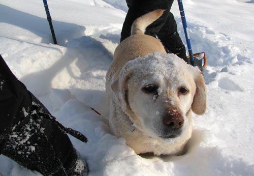
Tokul was breaking trail for us, at least when her path happened to cross with ours. She was up to her chest in snow, but it didn't really seem to faze her. When she disappeared over a rise above us we knew we were at least at a flat spot if not the ridge itself.
When we got to where she was patiently waiting for us we dropped some layers and had some water. At last, we could see the ridge that would lead us to the summit, but it was hidden by clouds. We broke left around a local high point and then traversed below another to avoid gaining extra elevation before the next saddle.
After the saddle it was a steady climb through the sagebrush and downed trees. The area had been burned some time pretty recently (I think) so what trees were standing were generally blackened by fire.
Below we could occasionally see blue sky. As we climbed higher we entered the mist and it was chilly with low visibility. The dead forest was spooky as it emerged from the fog. Our trail wound between the stumps and branches protruding from the snow.
I had set a turnaround time of 11am to ensure we'd be back at the house by lunch time with the kids. I was pretty sure we weren't going to get to the summit, but just being outside on the open ridge was a blast so I hadn't bothered to check the GPS much. When I did take a peek it showed we were nearly there and a few moments later it beeped indicating we had conquered the mountain. (And a few moments after that we were actually at a point where all directions were down.)
The summit itself was underwhelming. I stepped up to the highest mound of snow to formally claim the season's first winter ascent by someone named me with a dog named Tokul and a father-in-law named Carl. Carl pointed out I appeared to be standing on a bush, but the scrape of my snowshoe proved it was indeed rock (and a little bush) that I was standing on.
We were granted a few blue sky moments and could see the surrounding hills that sparkled against the blue sky. The trees around us were coated in thick snow and when the sun pierced the fog it made great patterns streaming through the branches. It was 10:58 so we headed down.
As always, down was easier than up. Except I kept stopping to take more of the same picture. As we dropped in elevation we lost the periodic blue skies in favor of pure mist, but that just made it more fun to tromp through the snow. I tried to high step through the powder, but it was so dry and so shallow that I kept catching on rocks. Still, we cut most of the switchbacks we'd carved on the way up in favor of heading straight down.
We made only one major change to the route in the descent to avoid gaining and then losing another 50 or so feet. Instead we dropped into a bowl and rejoined our trail on the other side.
The final descent to the Sno-Park was hairy as there was little traction to be had short of kicking steps in backward. I opted for sliding completely out of control and Carl did the same whether he intended to or not.
It'd taken us about two and a half hours to get to the top, but only an hour to get down. We were home shortly afterward and got to have lunch with the kids.
Total distance was 2.25 miles with 1,310 feet of gain.