Howling winds, soaking mists, and soggy ground. Lousy conditions for a concert, huh? That's what we thought and so we decided to bail on the last concert of the Pine Lake Park season. Lame. Especially since it was the symphony, which is usually pretty good. Definitely better than some of the weirder acts they've had this year.
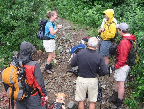
It turns out these same conditions, magnified in the mountains, weren't much better for hiking. Of course, it's a Thursday night and that means TNAB and that means comfort and enjoyment are not prerequisites. I made it to the sooper sekrit (misspelled to keep people from finding it via a search) trailhead that has become not so sooper sekrit so I could probably call it the super secret trailhead, but really it's just the trailhead now. (I remember the good old days when nobody would tell me how to get there and I had to piece it together from conflicting and confusing clues. Ah... thems was the days.)
The road to said trailhead has been getting worse over the years, but it's still passable in a commuter car so at least I saved gas getting there even if I should have carpooled. Next time.
The mist was heavy, but not actively raining. Still, I put on a full complement of rain gear, but with all the vents open. Of course, I'd forgotten the first part of the trail pushes through some fairly thick brush that demonstrates the whole road-to-trail theory even if it's not terribly fun. I paused to batten down the hatches before catching up with the crew.
I thought I'd done really well last week on Wright Mountain with an aggressive pace that just pushed my limits. There's a couple from the Peninsula who hike really fast and I quickly saw them disappearing up the trail. Two others managed to keep up with them.
There were two couples who weren't keeping up with me so soon I was hiking alone. Not even Tokul was with me, though that was so she could retain her cleanliness and, more importantly, I wouldn't have to suffer the trauma of giving her another bath. (There's a reason she usually goes to the groomers...)
I passed two pairs of hikers on their way down. All were TNAB, but they had decided to call it quits before the summit. One muttered something like, "This isn't what I had in mind."
Where the forest opened up I could see flashes of color ahead of me through the trees. If they stopped I was perhaps four or five minutes behind them. However, they didn't stop. I made it to Lake Lillian in just over my personal record time (about 25 minutes) and pushed on over the rock face around the east end of the lake. The last time I saw the lead group they were a third the way up the gully leading to the ridge. I'd have yelled something witty like, "See you at the top!" but I didn't have the breath. I settled down into a more maintainable pace and pushed up the gully.
At Lake Lillian there was just enough visibility to see persistent snow in a couple of hollows. It was leftover from the long, hard winter and a testament to just how much snow fell. At the top of the gully visibility dropped dramatically. Wind blew the mist and, now, sometimes rain up the cliffs reminding me that although I'd followed the ridge's edge last time to Rampart Ridge today wouldn't be a good time to try to repeat.
Of course, that meant I had to try to figure out how to get to the summit through the interconnected basins. I'd come down this way last time, but it was dark and two years ago. Trails faded in and out. I made a couple of false starts in the wrong direction, but with navigational tools (ie, Mr. GPS) kept going in the right direction.
Usually, there's two small tarns still full of water on the route. All the others are long dried by late August. I found many more of the little lakes than I remembered from the last time and at least one of them submerged the trail.
Looking ahead I could see a figure moving against a gray backdrop of dirty snow. Ah ha! Finally, I'd caught up! Surely, they must know where they're going!
Maybe (actually, discussions later turned out he was not better off than I), but it didn't matter. By the time I had climbed the snow finger to the next basin he was gone. I found a well-defined trail and took a few steps in one direction before realizing it dropped far too far to be where I wanted to go. I heard a disembodied voice call out, but without discernible words.
"Can you see me?" I shouted into the fading light.
No answer.
So up the trail I went. Looking back I saw a distinctive tree on a ridgeline that I recalled from a picture I'd shot on the last trip. Hurray! I'm on track at last. It was a short hop to the pass and from there another short climb to the summit ridge. The actual summit is a massive rock with tons of ledges. I arrived just as Damon and Don got there. Steve, Jeremy, and Tisha were already on top and warned us about the nasty slickness that made the usual approach not too feasible. The three of us worked our way along narrow ledges until we found a sort of staircase leading up.
I ventured out onto the "Diving Board," a rock platform that sticks out over the massive drop to the Gold Creek valley below. It was a good thing I couldn't see how far down it was. As I retreated my comments were perhaps a little less than manly and we decided I was far more moose than fish at that point.
It'd taken about 1:45 to get to the top (for me, anyway) and the light was fading fast. We drank a bit and I got razzed for having my customary pbj. We decided it was highly unlikely any of the rest of the party were going to make it up so we headed down.
The rocks proved just as nasty on the way down as on the way up. Jeremy nearly had a nasty fall and Tisha assured me there was nothing embarrassing about using the "butt scoot" method of descent. Two of the dogs had to be helped down the last step, but there was no disaster. (Tokul didn't even get close to the rocks when we were there last.)
Just below the pass we ran into the other four. Scott and Jo were probably close behind me getting to the top of the gully, but I was already out of sight around a corner when they looked for me. They hadn't been this way before and weren't convinced the way they were heading was right so they waited for Mark and Yet to arrive. (Mark's the TNAB leader and knows this trail well.) Turns out they were going the right way, but without confidence in that they made the right choice.
They turned around with us even though they were only about 15 minutes short of the summit. As we descended I realized that I'd been mostly right in my route finding. As the darkness became complete we stuck together more, waiting for everyone to clear one area before moving to the next. The trail had been slick going up, but was not treacherous going down. There were a couple of falls, but nothing serious.
Back at Lake Lillian we manhandled dogs across the rock, but it was too much for one of the party. I pointed out the way over the hill and around the rock and met them at the top to guide them down.
The final near miss was taking the trail back to the official trailhead rather than where we had parked. We figured it out a few meters down the trail and I went off-trail to join the main trail. Along the way I found a discarded inflatable raft and decided to pack it out as trash. That was hard. Heavy and awkward, but it made me feel like I'd done something good.
Even though it was already 10:30 (early for a TNAB return, actually) most of us decided to head to the Pour House for dinner (for those of us without pbj goodness on the summit). I got home a little after midnight and after hanging up my gear to dry and a shower I crawled into bed without disturbing Amy for a whopping three and a half hours of sleep before work.
About five and a half miles round trip and 3,500 feet of gain.