I've been bad. Twice now I've skipped a concert with the kids to indulge my fascination with the mountains. I am shame. (I still went, but...)
It was a repeat of last week on Red Mountain, but this time it was Bryant Peak promising route finding, veggie belays, snow, and loose rock scrambling. Amy and I went through the whole list of pros and cons again and again it came out that hiking would be the victor.
Once Amy had left with the kids for the concert I had a releaxed departure. Poor Tokul was going to sit this one out due to the sketchy final summit (she didn't actually summit on Red Mountain, but came within about 10 feet of the top) and she wasn't shy about letting me know she wasn't happy about staying at home.
I arrived at the Denny Creek trailhead really early. Not quite the first one there, but third. And the other two were also North Benders. Gradually the rest of the crew showed up. (Actually two had left early in hopes of getting to Hemlock Pass a little more leisurely.) We left right at six armed with all manner of gear for the unknown (to us).
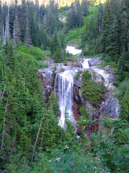
I hadn't been up the trail in years and it was a nicer day this time. Blue skies compared with the clouds and mist of the last trip. The way is pretty flat through the Denny Creek valley, but then climbs steeply to Hemlock Pass. We arrived at the pass after about an hour and met Yet and Colleen who had left earlier. They said there were three others somewhere to the east of us that might be TNAB, but they weren't sure.
Our beta indicated we needed to follow the trail toward Melakwa Lakes for about 100 yards (so began the counting of strides) and then follow a talus field to the east up to a ridge. At precisely 104 strides we found a fall of rocks and started climbing. (At precisely 120 strides we would have found the actual talus field, but oh well.) The rocks dropped us atop a little ridge with snow on the other side. Without a trail we wound around the mini valley until we found a spot that looked like it might go.
It's these sorts of decisions that I look back on and think, "Yep. That's where it got interesting." The way quickly deteriorated into a scramble up through brush over our heads. Thankfully huckleberries and cedars are remarkably strong so we were able to pull ourselves up the steep slope until we reached another snow-filled depression.
The way from here seemed pretty straightforward. We could see the summit above us. Although there was theoretically a trail that would deliver us to the top it was faint and more trouble than it was worth. Instead we all picked our own lines and headed up. The lower part of this final push wasn't as much of a scramble as Red Mountain had been. It was more walking over talus until the very top, which was solid rock (with the requisite loose stones justifying my helmet). Tokul would surely not have been able to make the final push and would have wound up stranded 100 or 200 feet below the summit.
On the summit there were two high points. We started on one, but fearing the other might actually be higher we gathered there. As I was moving from the first to the second I heard exclamations as one the crazy Schmidt team appeared on the summit. They had started half an hour after the rest of us, left almost all their gear at the trailhead, and actually jogged up the trail behind us. Freaks. I stepped up my efforts to get the to the true (or at least second) summit before she did. Whew! Close call.
Look around as much as we did (the view was stupendous, especially down to the still frozen and aptly named Snow Lake) we didn't see the three supposed TNAB hikers that were ahead of our team. Once everyone was on the summit and we got the requisite group picture we started down. Even though I was the only one in a helmet I wound up being the last (or near the last) to leave the summit meaning virtually nobody was kicking rocks down on me. Oh well. So much for planning.
As the sun set over the peaks to the west we dropped down the rock and talus and back into the nasty huckleberry slopes. (It'd be a different story if the berries were ripe, but we're still a few weeks from that if not a month or more.) As bad as the climb had been through the brush it was worse going down in the dark.
Back at Hemlock Pass we counted and found we had everyone. We had seen the other hikers off to the east, but didn't make contact with them. It was getting late so we took off down the trail making great time under a nearly full moon.
We left the trailhead at almost midnight, which didn't bode well for those of us planning for work the next day and even worse for us getting up at 4:30. I guess that's the price you pay for getting out in the middle of the week.
Total distance was about 8.4 miles and 3,300 feet of gain.