It started as a hike with one other hiker. Add her two dogs and three more hikers and Tokul and now we're talking about a party! However, when it came time to actually meet up there were just three hikers and two dogs. As a lesson in planning a group hike this was great. Aim big and don't sweat the drop outs.
It started a couple of weeks ago when I found out we were heading down to Portland again. And once again I was given a day to hike. It's getting toward the end of the winter, but Mt. Hood is 11,000 feet high so certainly there'd be snow somewhere. But to hike in the snow I needed partners. So I posted online for anyone who'd be in (or willing to travel to) the Portland area.
Hello, Action Betty. (Yes, everyone online has a goofy handle. What are you going to do about it?) Denise was from the Tri Cities, but was willing to drive at least two hours to meet up in Hood River about and hour east of Portland. Great.
Over the next couple of weeks we added Chief Paulina (Gevin), Tazz (Anne), and finally Bryan (Bryan). Denise would be bringing her two dogs and I'd have Tokul.
Bryan called me on Thursday with the lousy news that his car had been broken into while hiking at Eagle Creek... where I had suggested he do a day hike the day before. The losers had stolen his sleeping bag and tent (both newly purchased) that he had planned to use to stay the night until our hike the next day. Without those bits of gear Bryan had to bail and drive back to Seattle.
Gevin called Friday morning saying he had to bow out to take care of some business. Blah! (Still, he took me up Paulina Peak so I'm not gonna complain too much.)
Denise, Anne, and Mr. Big (one of Denise's dogs) were still in, though, and I found myself in a parking lot in Hood River around 7:15am waiting for them. (We'd driven down to Portland to stay with Grams and Gramps the previous night rolling in around 11:45pm. Ugh.)
Coffee, lack of sleep, and excitement had me all jittery.
We were going to head up the Cooper Spur on Mt. Hood. Yes, the same Mt. Hood where there have been a bunch of accidents this year, but we were staying relatively low and were three cautious folks so no worries. (Plus you're reading this now so all turned out well.)
Once we discovered there were more than two McDonalds next to Starbucks in Hood River (go figure) we hooked up. I threw my gear in Denise's truck, Tokul hopped in the back with Mr. Big (a really sweet black lab) and we were off. From Hood River it was a 45 minute drive to the Cooper Spur ski area and the Tilly Jane trailhead. Along the way we could see obstructed views of the mountain (or most of it) and even, according to Anne, a part of the Cooper Spur we were going to climb. There were high clouds obscuring the summit, but down low it looked like decent conditions.
At the trailhead we geared up and I again realized my daypack was too small for a trip requiring extra gear. Even with snowshoes strapped to the outside and leaving my extra warm gear I had to squeeze to fit everything in. Usually, this wouldn't be a problem, but I had my brand spanking new crampons (happy birthday to me) with 24 amazingly sharp points. Luckily, Denise had a set of point protectors (which sound like that should be protecting the points but are really protecting everything else FROM the points) so I defused their threat with those. With such a full pack I had Tokul carrying her own food and supplies in her pack.
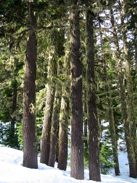
The trail started... well... lousy. We were in trees on a packed trail with no views and not too much of interest. As usual, Tokul hiked with whoever was in the lead, which wasn't me. The trail follows Doe Creek for the first half mile or so before heading up onto the ridge at a junction with the Polallie Ridge trail. I was a little alarmed that there was so little snow. In spots you could see the ground and it was oddly warm out. In fact, we had to stop and strip down before we'd gone too far.
Once on the ridge the trip was a little more exciting, though not much. The sun popped through the high clouds a couple of times and we could look across the Doe Creek valley to the trees on the other side. Nothing spectacular, though.
At about three miles in we came to the Tilly Jane campground and ski shelters. When I think of a ski shelter I envision a tiny little hut with a piddly wood stove and maybe room for a couple of people. This "shelter" was about the size of our first house. (Ok, perhaps a bit of an exageration, but not by much.) On the first floor were big tables and a huge stove. Wood was stacked outside by the toilet. Upstairs was room for perhaps a dozen or so sleeping bags and a little balcony as well. We all went inside (except Tokul who refused to even consider it) and ate lunch. The food was good and revived us a bit.
We were at about 5,800 feet and had already climbed about 2,000 feet from the trailhead. I had accomplished one of my goals and tried out my new crampons. The conditions didn't really call for them, but the trail traversed a steep section that I slipped on at least once so it wasn't totally false, but I wouldn't have been stressed if I didn't have them.
From the cabin we started up again. There were fresh ski tracks that must have belonged to the one other car at the trailhead, but we diverged from them at the second cabin. We crossed tiny Tilly Jane Creek where we could see at least 10 feet of snow piled above a trickle of water at the bottom. On the other side were two more cabins, but both were locked up tight. GPS indicated we ought to head back the other way so we crossed the creek again and headed up through the trees.
In short order we found ourselves on the edge of a mild gully that led out of the trees to the open slopes above us. The skiers swooshed down past us and the dogs had serious thoughts about giving chase, but came to their senses when they could only just make out the skiers disappearing into the trees below us.
Although there had been some steep sections on the trail before it had been a fairly mellow climb. It was no different here. The angle of the slope was modest and now that we were approaching the tree line I was pumped to continue. After all, getting above the treeline was another other goal for the day.
Unfortunately, just as we cleared the trees and entered into what would be rocky meadows during the summer the clouds blew in. What should have been views of the north face of Mt. Hood were instead views of a gray mass. We continued up weaving through the trees and angling toward the northwest edge of the Cooper Spur. One ridge separated us from the moraine of the Eliot Glacier. It was mostly clear of snow courtesy of the winds that batter the area.
Speaking of wind, it chose around this time to make an appearance. We were out of the shelter of the trees and the wind would rise from the west and blow stinging snow and ice right into our faces as we climbed the barren slope. A GPS waypoint that I set roughly where I guessed the shelter would be was all we really had to guide us toward our final goal, the Cooper Spur shelter.
Looking up the slope we could see mammoth boulders. Peering through the blowing snow I headed toward one gray blob that turned out to be a big rock. To the left of it were three more blobs, but one seemed to be a little too straight and orderly to be natural. As we got closer we could pick out the neat rows of rock that formed the walls and knew we had arrived. (Turned out the waypoint I had set based on where the Tilly Jane trail crossed the 6,600 foot elevation line was really accurate.)
To our disappointment, the shelter was full of snow so we couldn't go inside. Strangely, the shelter and the surrounding boulders were ringed by troughs melted into the snow. When the sun heats the rocks it melts the snow around them. Cool.
We hung out in the lee of the shelter to get out of the wind. Tokul finally got the food she had been carrying in her pack. Mr. Big dug in the snow and occasionally let loose with a burst of energy that usually resulted in a barely tolerant look from Tokul who was several years his senior. We talked about two of the climbers who disappeared on this side of the mountain and who still haven't been found. The thought was chilling and so was the wind. We stayed at the shelter for about half an hour before starting down.
The mountain never showed itself.
We made great time on the way down. The blowing snow had almost completely covered our tracks above the treeline, but Anne had paid good attention to our route and guided us back with no issues. (GPS had also recorded our route so we could have followed that back, too.) Once back in the trees the wind let up and we were able to shed our hoods if not more of our insulation.
We tried a few glissades, but the slopes weren't really steep enough and where they were there was a little too much fresh snow. We had only a few good runs. My best one was also my last as I rolled over on to my hip to lift my snowshoes off the snow. Two thoughts flashed through my mind. (1) This is how I broke my ankle last year. (2) Why am I sliding on the same hip I slid down the stairs on? Ow ow ow ow.
I ventured to the edge and looked down into the old moraine that Polallie Creek flows out of. The walls were amazingly steep, but of course as soon as I got my camera out the clouds rolled back in.
Back in the trees the temperature had warmed up so much the snow was melting off the trees and it started raining. Through the drizzle I looked up to see blue sky to the north. Figures. (I choose to believe the views from the shelter were still socked in.)
The trail out was the same we had taken in, but seemed to drag on and on. The last half mile was the low point. We had taken off our snowshoes and were postholing with some regularity. Not much fun at all.
Back at the cars at last we shed our wet gear and headed down the mountain. In Hood River I thanked Denise and Anne for a great day on the mountain. Had it not been for them I wouldn't have ventured beyond the area of waterfall hikes I've done on previous trips to Portland. Getting above the tree line was definitely a highlight even if I didn't get the spectacular multi-volcano views that this area has to offer. It's just another reason to come back.
Total distance was about eight miles with 2,800 feet of gain.