It had been a trying day at Snowhouse IV. Lilly and Clara were both out of sorts. Neither had done much sleeping and both had fussed most of the way through the day. After dinner, or that time when we sat with the girls at the table while they screamed, we put got them settled enough to entertain the question of a night snowshoe.
When putting together the itinerary for Snowhouse there were four snowshoe trips planned. My challenging trip to Paulina Peak, a day trip with the family, a day trip up Mt. Tumalo, and a night trip. I had pretty much written off everything after the Paulina Peak trip when the girls took turns for the worse, but Martin brought it up and Nicole and Amy backed the idea.
Half an hour later the four of us were in the truck heading toward Mt. Bachelor. At least we thought we were going toward Mt. Bachelor. The road was supposed to be signed "45," but it was Spring River Road. Occasionally, we saw signs pointing the way to Mt. Bachelor so we figured we were on the right road and in fact we were. Not that Amy didn't doubt my masculinity by questioning my route... Hmph.
12 miles from Sun River we wound up at the Edison Butte Sno-Park. There was only one other vehicle there, a motorhome with a snowmobile trailer parked behind it. The guide book we were using, Snowshoe Routes: Oregon, indicated the Nordic and snowshoe trails started at the east end of the lot. I was worried we were in for another trip of "don't step on the ski tracks," but there were two separate routes indicated on the map. Each route was marked with a different symbol (a cool snowshoeing dude for us) so there was little opportunity for confusion.
The moon was always visible, though sometimes filtered by high clouds. Our headlamps were, for the most part, optional. They were useful for picking out the trail markers on trees, but otherwise blended with the moonlight.
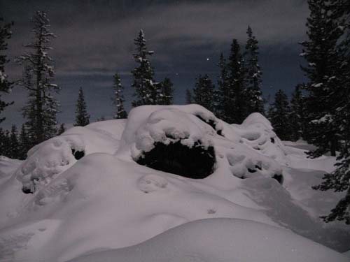
The trail wove between clumps of rocks that peeked out from beneath a heavy blanket of snow. There was no single big uphill or downhill, but instead a rolling series of climbs and drops.
We had one minor detour where a pair of heavily-used trails crossed and we took the wrong fork, but figured it out pretty quickly after seeing there were no markers.
We stopped to enjoy the views and I looked up randomly. "Gee, that clump of snow looks an awful lot like an owl." (Of course, being on the giving and accurate end of a disagreement about owls ("When's the last time you saw a flock of owls? In the daytime?") I was a little tentative.) When the clump of snow moved its tail, however, I pointed it out to the others.
So began a solid 10 minutes of pictures with the owl silhoutted by the moon with flashes and without. After saying thanks to the owl for posing we continued on. Pretty quickly we intersected with the long loop (an extra mile in length) and a 1/4 mile spur to the Edison Shelter. We opted to have some cocoa on a pile of snow-covered rocks rather than head to the shelter and add an extra half mile.
The final mile back to the car was more of the same. Still gorgeous, but it was getting late and we were getting tired so we headed straight back.
The book listed a 20 foot difference in elevation between the start (5,080 feet) and the Edison shelter (5,100 feet), but over the 2.5 mile route we did there was probably something closer to 300 feet of gain over the rolling hills.
This loop, or the longer one, would be great spots to check out in the daylight even if the likelihood of seeing an owl would be significantly less. (Well, duh.)