Whitebark (not his real name) (duh) has been working on building a new trail up Change Creek just upstream from our house for the last... oh... I don't know. (Really, I don't.) The route starts just east of the Change Creek trestle on the Iron Horse. We parked at the climbers' trail and followed their crude trail up the creek.
Scott, our new downstream neighbor, was unexpectedly impressed with the modest beauty of Change Creek between the trestle and the road. Huh. Most of his hiking has been in Missouri and California. You can draw your own conclusions.
We had no problem finding the start of the trail just west of the Hall Creek trestle. Climbers were everywhere doing their thing on the steep cliffs so we got barely a second look as we headed off onto a scratch of a trail.
As soon as we left the Iron Horse the trail climbed quickly. At the second switchback was a hand-drawn sign letting us know we were in the right spot and giving some mileage. Our plan was to go until we didn't want to go any further so the mileage wasn't all that important. On the map it looked like you could run the ridge all the way up to a peak just north of the Cedar River Watershed boundary with good views so that was one option. Another was to make fo the lake near the headwaters of Change Creek. Since the trail connected with the Mt. Washington trail that was yet another way out.
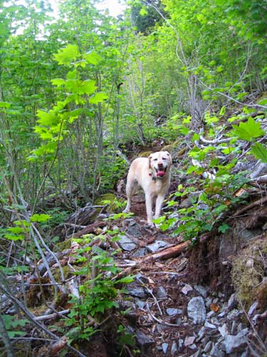
Before we made any of these decisions, though, we had to climb the hill in front of us. The trail was good in some spots and barely discernable in others. It climbs steeply to gain the ridge with a bunch of switchbacks following the natural contour of the slope. All in all, a spectacular job of unofficial trail building. Two spots are marked with little signs. A view up the Hall Creek drainage incuding a neat little waterfall and "Whitebark's Bivouac," which is a little hollow at the base of a cliff. Tokul poked her head in, but it was too small for Scott or me to go in.
1,200 feet of gain from the cars we saw sunlight spilling over the hill above us and popped our heads up to see... hmm.... not much. Mt. Washington blocked views to the west and we weren't high enough to see over the ridgeline to the south. Oh well. There's more trail to come.
From the ridgeline the trail continues south along the crest until it intersects the end of an old logging road overgrown with alder. The "official" route abandons the ridge and follows the road to a lake. After the quick climb the prospect of bashing through the brush for another 1,000 feet of vertical gain wasn't that appealing so we took the road option. The alders were fairly sparse and some clearing had been done so it wasn't hard to follow.
Correction: It wasn't hard to follow for a while. Unfortunately, after crossing the creek there were fewer and fewer areas that had been cleared until, right at the lake, we couldn't find any sign of trail work. Following the road wasn't a problem, but getting through the heavy alder growth was. Tokul took the low road and ducked beneath it, but Scott and I were stuck going through, over, or around it. The worst of it was only about 200 or 300 meters, but that was enough for us to wonder if continuing was worth it. (The fact that we were already half way through helped us decided to go forward instead of retreating.)
The lake is barely shown on the maps and with good reason. It's a small puddle with a muddy bottom. Not surprising, but not an alpine lake by anyone's standards. There was no obvious trail down (though one does exist, according to Whitebark) so we followed the road around.
At the south end of the lake I smelled a smell. What was that smell? "I smell pizza!" said Scott and suddenly I did, too. It was clearly the smell of pizza a couple miles up a little used trail. How freaky was that? Perhaps the bear or cougar or whatever had left the many piles of scat on the trail had ordered in. (Or someone had taken pizza up Mt. Washington and the smell drifted down to us.)
The alders petered out as we climbed the logging road up out of the valley. The views up the South Fork opened up (complete with I-90 and its quiet, but audible hum of commerce) and Scott was again impressed. I seriously need to show him some of the truly beautiful parts of our backyard and watch his eyes pop out of his head.
We rounded the shoulder of the mountain and found the Mt. Washington trail at about 3,800 feet. We contemplated continuing up to the Great Wall and maybe even the summit, but we had gone farther than expected already and heading down seemed a better option.
The trail down is uneventful. Berries were few, probably due to hikers munching them up to the Mt. Washington summit. Water was scarce for Tokul until we got way low and found a stream of water shooting from a crack in the rock. The last mile or so kept tempting us with views of what appeared to be the Iron Horse just a few hundred feet below us, but were in fact I-90 perhaps 1,000 feet below us.
Back on the Iron Horse we opted to exit to pavement at the parking lot near the west ramps of Exit 38 and walk along the old highway back to the car. Scott took a few quick steps at the very end and declared himself the winner. Hmph. (I'll have to try that next time I'm out.)
We were out for about four hours. Total distance was about 6.5 miles and 3,100 feet of gain. If Whitebark continues working on the trail it will continue to improve and as a backdoor access to Mt. Washington it's pretty good. I'd also love to see the trail continue up the ridge to the wooded summit above the lake. It won't have views to the south (blocked by another peak within the watershed), but would provide good views to the north and east.