I sped toward the trailhead convinced I'd be late, but found it empty when I arrived. I wondered a bit if one of the other cars was the rest of the crew already up the trail and pondered going up by myself, but given I wasn't sure the exact route I dawdled until the next car showed up.
Like my last trip with TNAB we started off together, but quickly spread out. Thankfully, a group of us formed up as we passed Talapus Lake and stayed together until Olallie Lake when we had to go off-trail.
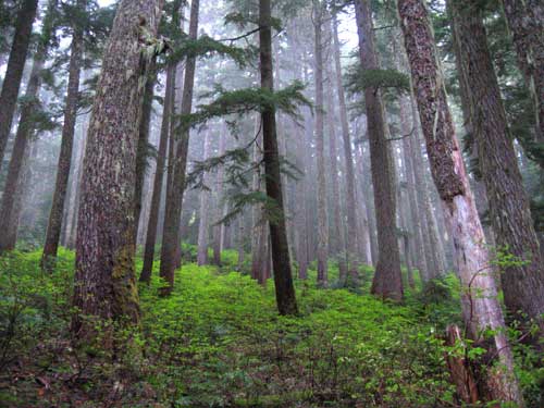
The route was up 400 feet of brushy forest and mossy talus. In less than a fifth of a mile we rejoined the trail that had wound around the north side of Olallie Lake. The shortcut saved about a mile. (The shortcut crosses Pratt Saddle, which was the destination for a 2002 hike with Dan.)
Above the lake we would have had great views of the west side of Granite Mountain and the north side of Bandera Mountain, but the low clouds obscured just about everything. We could see Talapus and Olallie Lakes as well as the lakes below Bandera's summit. Island and Rainbow were still snow-bound, but Lake Kulla Kulla was snow-free.
The trail was in great shape with only a couple of blow-downs to cross. However, we weren't destined to stay on it for long. A flag on a branch marked the spot we needed to head off-trail again.
There's no trail to the summit of Pratt Mountain, just an open talus field almost 550 feet high. Snow covered the bottom and top of the field. Yes, I know. I tore up my shoulder climbing a talus field quite similar and it spooked me here, too. At least Tokul wasn't with me. She couldn't have dealt with the rocks and I wouldn't have been able to summit.
As it was, the climb wasn't really that bad. The rocks were bare and rough and easy to get a grip on, unlike the mossy talus on the last off-trail section. I joined the crew on the summit and busted out a tupperware full of monster cookies Amy had charged me with disposing of. I was now a hero and nobody accused me of overpacking. HA!
With no views and the mist sapping our heat we didn't stay long at the summit. The route down the talus wasn't as much fun as going up, but by crouching and swinging on my arms it seemed fairly safe. In a couple of spots dirt had filled in the gaps and allowed everything alpine from blueberries to trillium to grow.
Back on the trail we cruised back to Olallie Lake. It had taken almost exactly two hours to get to the summit so by the time we were back at Olallie it was about 9pm and getting dark. We continued down the trail with the light failing with the intention of getting to the cars without having to switch on our headlamps. Some macho thing, I guess.
Still being new I figured I'd play along, though by the very end I was close to caving to the desire to see, but fought it off as the trail got better and better. From the summit it was another two hours to the cars.
According to Topo, the route is about 7.5 miles and 2,500 feet. I wouldn't try it with lots of snow or in the rain, but if the sky is clear the views would be well worth it.
Plus, now that I've completed two TNAB trips I'm officially a veteran. Hoo Ah! (Or something.)
(Don't like my report? Check out the official TNAB report.)