With a three day, 40 mile hike in just two weeks I figured it's about time I started training... or at least got used to having 50 pounds on my back again. After all, it's been almost a full year since I've shouldered my heavy pack. (Hiking to the falls with the girls doesn't really count. It's the same weight, but only a short 3.4 mile trail with limited elevation gain.)
So I picked Granite Mountain. It's been on my list for quite a while and needed some attention. It's extremely popular, so I wanted to get going early, which usually means it's just me and Tokul because no one else is crazy enough to get up at 5am for a hike.
Apparently, Darryl, one of the Mommy Group daddies, has been itching to go hiking for a while. Or at least his wife has been itching for Darryl to go hiking. I'm still not completely clear on this. Regardless, with him as a hiking companion my requirement to get back by 11:30am was no more so we chose the more civilized 7am departure from North Bend.
Although this was a well-traveled route I thought I'd check out the scene from above. I was surprised to see the trail clearly visible as well as an airplane caught flying above it.
When we got on the trail at 7:30 there were two other cars in the lot. One belonged to some overnighters at Pratt Lake (or somewhere down that trail) and the other had a pair of runners in it. They looked like they were getting ready to go, but since they didn't pass us on the trail either they went somewhere else or they were coming back.
The first couple of miles is in heavy woods. The grade is very gentle up to the split. We went east while the other route headed west toward Pratt Lake. From the intersection the trail became more agressive and soon began cutting across a couple of gullies known for avalanches in the winter.
Friday it had poured rain and I was fearful that this hike would be a sodden one. However, as we climbed higher and higher we broke out of the clouds and could see them flowing through the valley below us. Above was only blue sky and an increasingly hot sun.
After about two miles on the trail we broke out of the trees for the last time and were on an open slope full of rocks and flowers. The berries weren't out just yet, but they will be soon.
We came to a saddle in the ridge with a stagnant little pond. Although I was tempted to let Tokul get in for a swim and a drink the red brown color turned me off the idea. She strained against the leash, but after a few pictures we continued up the trail that ran on the north side of the ridge.
This section was the best of the entire hike. It's pure alpine meadow. Few trees, lots of rocks, lots of wild flowers. The views south were blocked by the ridgeline, but the views to the north made quick appearances between the little hills.
The final climb up to the summit and lookout switchbacked among stunted trees and over boulders. We caught a glimpse of a couple of lakes and pushed through some brush to see Crystal and Tuscohatchie Lakes hundreds of feet below us. (Crystal is apparently where the rangers go for water when they're at the lookout.)
We rounded the last corner and the lookout stood above us on a monster pile of rocks. We'd been passed by three people on the way up, but they had already taken leave of the summit so we had it all to ourselves. We staked out a spot on the southern edge, tied Tokul to the supports, and drank in the views.
Mt. Rainier was unavoidable, but Mt. Adams peeked above the hills and of course the whole of the central Cascades were laid out before us. To the east we could just see Keechelus Lake past the Snoqualmie ski resorts. To the west we could see civilization blanketed in the clouds. (The north views were blocked by a few trees on the other side of the lookout.)
Very shortly after we got situated another hiker showed up. A few minutes later and another pair arrived and then another. Two more came around the corner, but they had a reason to be there since one was the ranger occupying the lookout. Two hikers asked to go up to the catwalk around the outside of the lookout and offered water as a bribe. Since the nearest water was down at Crystal Lake it was a valuable commodity and was accepted.
Hmm... water will buy access, huh? Looks like hauling 30 pounds of water up the mountain wasn't such a bad idea, even if the two gallon jugs came from the rain barrels out back and weren't really drinkable. (Not to mention one of the milk jugs leaked copiously so the bottom of my bag and shorts were soaked.) However, the four liters I had taken from the tap were sure to bring me accolades upstairs.
Actually, it was only three liters. Tokul had about half a liter and I dumped the other half into my camelbak. (Good thing, too, as I was completely dry by the time we got home.) The ranger wanted to be sure I wasn't being too giving, even if it was her birthday, but I assured her the water was just for training.
"Training? For Rainier?"
"No, just the PCT."
"Which section?"
"Well..."
After making my donation I wandered to the south end of the peak to get better pictures of the lakes while Darryl slept in the sun. The northern Cascades were everywhere, but Glacier and Kaleetan Peaks stole the show.
The hike down was unremarkable except for the never ending stream of people on their way up. Clearly, this was why we got up early to head out. People, people, and more people. It was almost like hiking Mt. Si. (Ok, not that bad, but really crowded.)
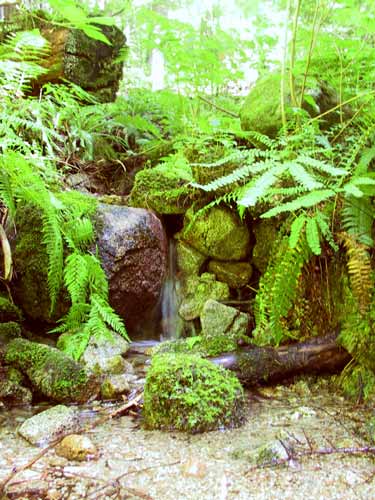
It took us two hours to get down with all the stops and a couple of long drinking breaks for Tokul who had been pretty much without since the summit. The section of the trail in the woods has lots of water running, though some of it isn't obvious as it springs from the ground slightly off the trail. A thirsty dog, however, will have no trouble finding it.
We got back to the car at 1:30pm. Three hours up, an hour on the top, and two hours down. 8.6 miles according to the Green Trails map with a total gain of 3,826 feet. Loads of switchbacks, but the views made it emminently worthwhile.
And Darryl... did I break Darryl? Not even close. Although he had some trouble with his knees on the way down he was the one waiting for me as I lugged my out-of-shape-self up the mountain. His only problem was bringing a really fancy camera that didn't have its batteries fully charged. Live and learn.