For years Bare Mountain has beckoned from the Alpine Lakes hiking book as one of only a couple hikes in the North Fork valley. After taking a trip up the North Fork a couple of weeks ago Bare Mountain's call was difficult to deny.
We left Starbucks in North Bend at about 8:15 and headed up the North Fork county road. Others have made it to the trailhead in 40 minutes, but we chose a much safer pace so it took an hour. (And that doesn't include the 10 minutes we spent driving to the end of the wrong road. Doh!) The road was clear up to the last few miles when there was some semi-nasty snow/ice, but nothing Dan's Subaru couldn't handle.
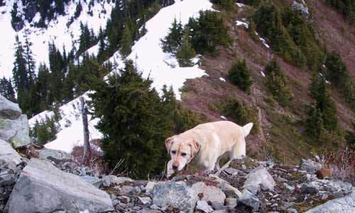
I had prepared for bad conditions so I had crampons, rain pants, long-johns, rain jacket, fleece hats, big gortex mittens (in addition to my normal hiking gloves) all crammed into my daypack. I started in just shorts, shirt, and a fleece, but did put on gaiters. The first 100 yards of the trail/road were snowy, but after that it cleared up.
Definitely, without question, the worst part of the entire trail is the first mile or so. It's an old mining road that looks like it has some serious water running down it so it's mostly just loose, fist-sized rocks. Ick. Happily, we were soon through it and to Bear Creek. We almost crossed right where the trail first hits the creek, but since it's just a sheet of rock with fast moving water we decided to try the stairs heading upstream. They led to a very sensible double-crossing that left everyone dry.
Once we got into the flat, open area paralleling the creek it was more of a trail. It was extremely open with all the ferns crispy and brown on the ground. No snow to speak of along the creek. At the first switchback we pondered heading over to see the mines, but we were hoping to get back in the early afternoon so we passed it up. Both of us were hiking in just t-shirts at this point.
After all the talk about billions of switchbacks we were a tad hesitant, but found they really weren't that bad. The grade was even, but not terrible, and there were enough shallow traverses to make it almost nice. We kept looking up the bare (get it?) slope hoping to see the summit, but the rocks we could see looked too near. (In fact, I don't think we could see the summit from the trail.)
Where the trail dipped behind some of the few trees there was a touch of snow, but never enough to be troublesome. There were a couple of little creeks that sprang from the hillside and one that shot down on a sheet of rock with moss borders. So very cool, but so very impossible for me to capture on (digital) film. Dang.
As we got near the saddle at about 5,000 feet the snow built up. Juneau ran right up to the edge of what was a BIG drop down toward the Paradise Lakes. Freaked me out something fierce. Tokul was much more conservative, thankfully. The north side of the ridge was caked in heavy snow and the lakes below us were still frozen over. The trail ran along the spine and back along the south side of the peak into blueberry bushes, though even in a relatively snow-free year like this they didn't yet have leaves let alone berries.
We tromped through one section of deep snow where we postholed on every step. It was perhaps three feet deep, but we sank in only as deep as our knees. Finally my gaiters and poles came in handy. The final short scramble to the top (not really a scramble, more of a steep trail) gave me the willies, but ended us up with a 5,300 foot, 360 degree view that was just amazing.
In different directions we could see Rainier, Glacier Peak, and Seattle backed by the Olympics. In every direction except due west jagged peaks raked the sky and most everything was covered in snow. Dan had given me a mini bottle of the new Starbucks Liqueur as a birthday gift so we cracked that open and discovered it was really tasty. The dogs continued playing near the edge, which made me really nervous, but nobody went over so I guess it's all good.
On the trip down I had issues climbing off the peak, but then no problems after that. The snow, rotten though it was, made for a fun run down to the saddle before the switchbacks began again. We paused at the cool stream and found a little waterfall that also defied my camera. One of these days I'll develop some photography skills.
We met one other couple on their way up about 1,000 feet below the summit. We saw no one else the rest of the way down. We were raving about the great trail until we hit the nasty rocks again and remembered how much our ankles wished for the solid uphill above the creek. Ugh.
We made it back in plenty of time. I was almost an hour and a half before my expected return, though Dan was pretty close to his. We need to learn to coordinate that in the future. This was likely my last hike of any significance for a while since Amy's due in only four weeks and it wouldn't do for me to miss that. Not if I want to have the continued use my legs, that is.