As you enter the logging roads in the old Snoqualmie Tree Farm (now owned by Hancock) one of the first landmarks you see is Fuller Mountain. It jumps pretty much straight up 800 feet from the valley floor and always seems it would have great views if you could see from its forested summit.
In days long gone by the Mountaineers gave pins to people who had climbed Little Si (check), Herpicide Spire/Cedar Butte (check), and Fuller Mountain (dang). Even though that program is long since gone it only made sense to complete the troika by getting up Fuller Mountain.
Dad had helped a lone hiker find the trail a while back and the hiker had told him it was the trail up Fuller. Huh. Go figure. None of the other maps I have show a trail. Just a couple of borrow pits and a lot of steep slopes. Turns out there is a trail and a pretty nice one at that. Heck, it's even easy to find and requires only a small amount of road walking.
We parked at the Spur 10 Gates and walked straight across the main line to a partially overgrown trail marked as a loop trail with the Weyerhaeuser logo. Just inside the trees was a 30 year old forest (last cut in 1984 according to the sign) that has another 26 years to live before it's scheduled to meet the saw in 2030. (If you're going to hike it you ought to go before then.)
The trail drops a little bit before arriving at Ten Creek. A trail heads off to the left, but stay to the right and cross the creek on an old log/bridge. It's been cut into pieces, but is still serviceable. However, keeping Tokul on leash while crossing on the wobbly log was a bit too much so Tokul was set free for the rest of the hike. The trail continues through the woods, crossing one road, for about a mile. At the end of the trail it pops out at a borrow pit at the base of the mountain.
We looked in vain for a trail on the other side of the road and eventually headed down the road leading away from the pit. At the first intersection we went up toward the upper level of the pit and found a trail on the left not too far up. Since there was no trail from the right we can only assume we were supposed to use the road.
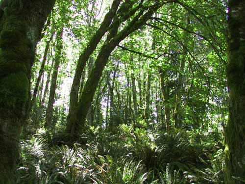
At this point the trail starts climbing in a long, gentle traverse up the hill. There are moderate views of Klaus Lake (probably) and the joy that is Snoqualmie Ridge, but mostly it's just a wooded trail on the side of a hill. The trail is in pretty decent shape, probably because it is rarely used.
There are four or five switchbacks that begin about half way up the slope and take you to a little false summit area. We pushed on and were soon at what we figured must be the true summit since there was nothing higher. This was right around a huge huckleberry bush which was happily covered with berries. Turns out Clara really enjoys them as do Tokul and I. (Dad only had a couple and seemed to enjoy feeding them to Clara more than eating them himself.)
The trail dropped a bit after the huckleberry bush and ended on a moss-covered rock ledge looking to the east. The Moon Wall of Mt. Si was the big landmark directly across the North Fork valley. Just at the far right side of Mt. Si we could see Mt. Rainier peeking out, but unless you were looking for it you wouldn't know what you were seeing.
We had some water, but I never dropped my pack and Clara's feet never hit the ground. The trip down was about the same as the way up. Nothing really special, but a good, solid trail.
Although Dad claims to have never hiked before (at least not for any purpose other than to get to a secluded lake or river for fishing) he didn't complain too much and might even be up for more. Heck, he asked how the climb up Mt. Si was so maybe there's hope for him yet.