So... yeah. I like to tell people I do stupid things so they won't have to. I don't think this one really counts as stupid, but it was stupid-adjacent.
It started with a 3am alarm that became a 3:09 snoozed alarm and then a 3:18 foot in the back pushing me out of bed. I rousted the boy and we stumbled downstairs. Even Starbucks is smart enough to still be in bed at that hour so we got in the car with our homemade drinks and headed to Mount Rainier National Park.
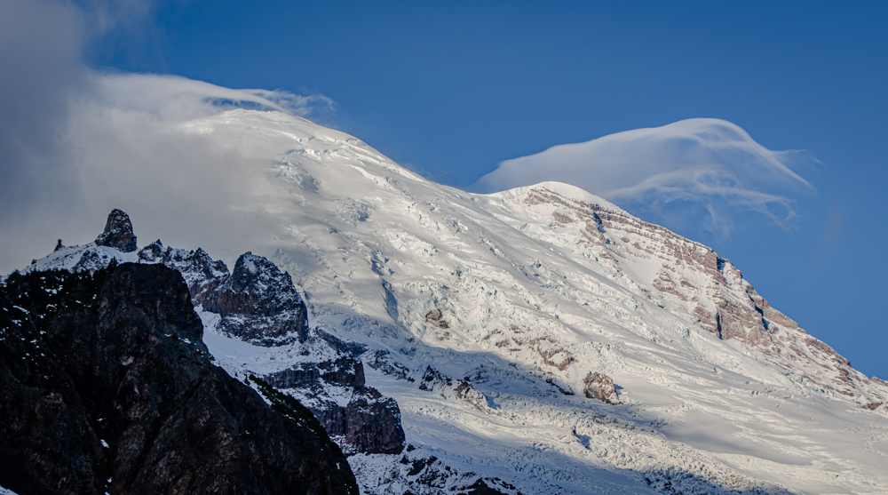
It was dark at the trailhead, of course, but the sky was clear. The forecast had called for clear skies until midday when the clouds would start rolling in. Time to move. The Wonderland Trail in the dark is a heads-down march. We made great time and crossed Fryingpan Creek as the sun rose. We had a few peaks at Tahoma lit by the rising sun. Lenticulars just tickled the summit.
Switchbacks led us up to Summerland. We had hoped to tackle Meany Crest, but the trail on the map was marked with the dreaded Meadow Stomper sign indicating going that way would be inappropriate. Dang.
No worries, I recalled the great times we'd had at Panhandle Gap so we set of in that direction. The first stretches across the rock fields were snow free, but by the time we got to the tarns the trail was intermittently covered in snow. The Gap was easily visible and we knew we were close so we just headed straight toward it. That's when we found the tracks.
Oh, goodie. We're not alone. But not in a good way. Usually a fresh boot track is a sign that we're unlikely to get lost and die out there. (Yes, if the tracks are one-way we might find a body and then we're screwed, but that hasn't happened yet.) These were animal tracks. Big animal tracks. The kind that eats other animals. And people.
(I remember the good old days when I could likely escape while a bear munched on a child. Now I'd be the one that would be dinner. Sucks for Henry though; I carry the car keys.)
Anyway... it turns out the tracks knew the best route to the Gap so we followed them. There was some minor discomfort in the climb, but it got really bad when we cleared the last shelter and the wind hit us in the face. The clouds had arrived while we climbed higher on the mountain from Summerland and they now hid everything more than a thousand feet higher than we were. In particular, they had consumed our backup objective of Panhandle Point. Well, this is where my inner voice says, "NOPE!" and this time I actually listened!
But not before we could get some SCIENCE! done. In fact, we managed to participate in four different projects on this trip. We collected scat for Cascades Carnivore Project, snow depth measurements for Community Snow Observations, pika observations for the Pika Project, and trash observations for Plastic Free Parks.
Our scientific duties done, we double-timed it down the mountain. It started raining lightly before we got to the safety of the trees below Summerland, but nothing like what came after. The mid-slopes of the Mountain got a bit of rain that turned to snow shortly after. The days of easy access to places like Summerland are just about over. If you go, be sure you are prepared for whatever might come.
📍On the lands of the Puyallup people.