Tiger Mountain is the last of the "Issaquah Alps" stretching from Issaquah to the Raging River near Snoqualmie. When you head east toward the mountains you may have seen the long (LONG) line of cars parked on the south frontage road off the High Point exit. That's one of the primary entrance points to Tiger Mountain. Add mountain bikers and horses and you can understand my reluctance to make it a day's destination when my hiking time is rather limited.
Still, I had half a day to hike with Clara, Tokul, and Dan since the girls were off buying plants. Most of the shorter hikes actually in the mountains are still locked in snow and I didn't feel like doing Mt. Si yet again, so we chose Poo Poo Point starting at Issaquah High School.
Although we had no difficulty finding the trail itself, we were blocked by the fence around the high school. We eventually found a way through and thanks to an older gentleman got started on the right track. The trail climbed and climbed, though not terribly steeply at first. We were walking through second growth forest (at best) with no real views or distinguishing features. Hmph.
We ran into a guy and a kid who looked to be heading down. We had found a frisbee earlier and returned it to them though we couldn't figure out what they might want it for. (Later we surmised that perhaps he was going to throw it from Poo Poo Point to see how far he could hurl it, but the implications of that were a tad too frightening to hope he'd get the chance.) They took off back up the trail and we figured we'd see them at the Point.
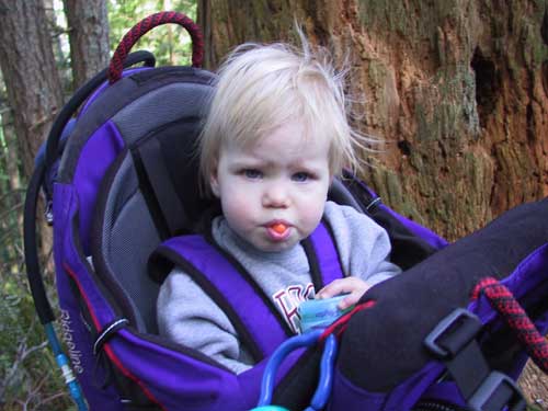
Clara was a bit fussy, so we stopped a couple of times to let her stretch her legs, have a snack, and generally wiggle. We tried adjusting straps and giving her toys, but it wasn't much fun for her, unfortunately. Of course, we figured we were just around the corner so we pressed on.
Just after we stopped we entered an area that had been badly beaten in the big windstorms in December. Trees were blown down all over. A lot of work had been done on the trail to make it passable, but still more will be required to restore it completely. Happily, it didn't hurt the billions of trillium blooming throughout.
After a big hill climb we came to a four-way trail intersection. To the left looked like a traversal which continued to the right. Straight continued up the hill. The sign that marked the trails had been knocked down so whether it was truly pointing in the right direction was unknown. The frisbee kid was coming toward us from the right hand trail and declared that it wasn't the way to Poo Poo Point. In fact, he said there was a sign at the bottom of a steep hill that pointed back up this way. Huh.
Well, maybe heading up the hill was the right way. The map labeled all the trails as "Tiger Mountain Trail" which wasn't terribly helpful and the batteries in the GPS were dead. Dang. Ok, can't go wrong going up so up we went.
The trail climbed for probably a half mile or more. We were stopped when a couple of runners came by. We asked if we were headed in the right direction and they told us we needed to go back to the intersection and turn left. In other words, go where the kid told us not to. We climbed a little more until we got to One View summit (or at least that's what we'll call it) which had fewer views that its name implied. We turned back and were soon a the crossroads again.
The runners must have known what they were talking about so we headed down that way. Yep, here's a downhill, but it's short and starting back up. Surely this must be the way. We started a much bigger downhill and soon crossed a creek where a sign pointed back up the way we had come. Damn: "Poo Poo Point" pointing in the other direction. Clearly the kid was right and the runners wrong. Back up we went.
If it wasn't the up hill trail and it wasn't the trail to the right it must be the trail to the left. (We weren't ready to concede that we'd missed the Point on our way up to the crossroads.) We followed it for a while, but it headed in the wrong direction entirely so we retreated, resigned to failure.
Back at the intersection we were preparing to head back to the high school secure in the knowledge that .6 miles down one of these trails was the Point, but we weren't going to find it. Just then an older hiker came up the supposed Poo Poo Point trail. We asked him where it was and he pointed back the way he had come. "But what about the sign?" That's the sign for the trail which continues down to the high school. The Point is only a couple hundred yards beyond that.
Experience won out, though it was perhaps a quarter mile beyond the sign that we found Poo Poo Point. There was an outhouse, parking lot (Huh? Turns out you can drive there if you know the right people.), and a bundle of people enjoying the sun. We sat beside the "runway" of astroturf where the hanggliders and paragliders (aka: fools) launch themselves to have lunch. Clara is enjoying feeding herself which usually amounts to taking a piece of food, holding it out to Tokul, me saying, "no you eat it," and Clara eating it. Sometimes she doesn't even wait for me to say anything and it just looks like she's taunting the dog. Amazingly, we could see the car, all of Issaquah, heck, just about all of the Eastside.
The trip back down wasn't really notable except the volume of people kept increasing. We had gotten on the trail at 8:30am. By 1pm we seemed to be passing people still on their way up almost every few minutes. Clearly, it pays to go early if you're going to hike Tiger.
In the end it was good, but not worth doing again. We probably tallied 11 or 12 miles with all our detours. Green Trails makes a special map of the area which I'll probably pick up so next time the real hikes are snowed in I'll know where I'm going. (Yeah, like a map will really help that.)