Dan showed up at 8am just as we were finishing breakfast. Amazingly, we actually managed to get out the door in great time in spite of having to include all of Clara and Tokul's gear.
The trailhead was way out at the end of the Middle Fork road. Although getting to the Middle Fork road is quick it's about half an hour or 45 minutes to get to the end of it. The county portion is in rough shape, but the holes are all very small. The National Forest section is almost paved it's so smooth, but there are huge holes that could swallow a truck. Ugh.
At 9am we were at the trailhead which is the end of the road, literally. There were two other cars parked on the west side of the bridge over the Taylor River which has always been closed. Surprisingly, the gate was opened, but since it had always had a sign saying it was unsafe for vehicles we thought it best to keep the truck on the right side of it.
The Taylor River trail is the old Lake Dorothy highway... or at least it was supposed to be. The books tell of a project to punch a road up the Middle Fork valley to the Taylor River valley, past Snoqualmie Lake, and down into the Foss River valley. The endpoint would be somewhere just west of Stevens Pass on Highway 2. It was an ambitious project which thankfully died.
The weather promised to be killer, but in spite of the sun it was quite chilly at the trailhead. We made good time and were soon at Marten Creek where a new bridge had been installed since the last time I was up the valley about a year ago. Dan and I had both been up this way to the split in the trail leading to Snoqualmie and Nordrum lakes and we were both pretty sure the concrete bridge was where we were heading.
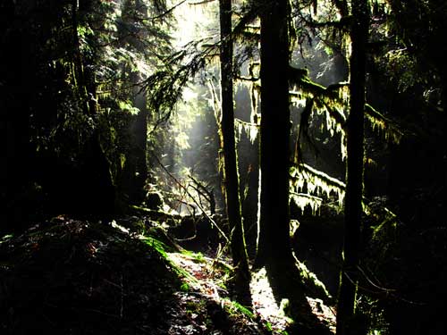
The snow started in earnest at a small creek so by the time we got to the bridge we were struggling through knee deep snow. Tokul was having a great time scampering about off leash and exploring most everything she could. She only got spooked once as we crossed a culvert that had water spilling out to the tune of a large animal (think elk) crashing around in the brush.
The waterfall at the bridge was great, but it was pretty obvious we were in the wrong spot. Dang. In our quest for the concrete bridge we had gone right by Lipsy Creek and found ourselves at Big Creek. Impressive as it was we now had to turn around and head back through the snow. Dang.
We figured it was about three quarters of a mile back to Otter Creek. We got there in only 10 minutes, but could hardly believe it was really our destination. The creek was a mere trickle. We poked around, but couldn't find a trail up the creek and wound up forging our own. Just a little way in it was clear we were not following a real trail, but through the trees we could see rocks that were probably Otter Falls.
When we came out into the sunlight we were amazed by the falls. The lake was a mere pond, but the falls seemed insanely high. Otter Creek slid down in lazy curves before plunging into the lake. Wow. Dan traced the shore to get on a small outcropping to provide scale. He had to take his boots off to get traction, but did successfully get in position to show just how tall the rock really was. (We thought it was perhaps 250 feet tall, but the book claims it's 500 feet tall. Either way, that's damn tall.)
Tokul had a great time splashing around while Clara got lunch. Unfortunately, this was her first swimming adventure of the season and she was a bit out of shape. The next day she had swimmer's tail. Seriously? Yeah. Turns out it's fairly common among labs because they use their tail as a rudder for swimming. They assure us she'll be back to her tail-wagging self soon.
Unfortunately, we admitted we did need to return to civilization. We had come in on the high, west side of the lake, but exited on the east side. As we crossed the outlet we met up with the first of what would turn out to be a flood of other hikers. The two we met at the lake seemed to be fairly knowledgeable, but the closer we got to the parking lot the less sensible they became.
We met folks who were dressed in all black that might as well have had the REI tags still on their new boots and we met people who wanted to know when they shut the gate. Even though we told them we'd never seen it open before they continued on their way. Half of me hopes they got out, the other half hopes they had a cold night locked in.
The most annoying was a pair of dirt bikers who had torn up the trail, but stopped to take a picture. We came close to telling them they weren't welcome on the trail and it was in fact illegal, but one of the guys was really big so we decided against it. We got back to the trailhead to see more cars than we had thought was possible.
Our little diversion to Big Creek had added about a mile and a half bringing the total hike to right about 10 miles, but elevation gain was minimal (only 650 feet or so). The only real trouble was the rotting snow. For so long I've been pining for snow on the trails, but when we run into it I get grouchy. I'll never be happy.