Nick and I met at the Starbucks in Monroe (our traditional Stevens Pass meeting spot) and headed up the hill toward Stevens Pass. Our plan was to climb to Merritt Lake just east of Stevens Pass. It took almost an hour and a half to get to the trailhead only to find the trailhead was a wall of snow with a stop sign poking out the top. Dang.
To make matters worse, the closest place to park was a mile to the east. We checked the maps and decided we'd be better off parking at the turnout that was only three quarters of a mile to the west. When we got there saw it was right under the powerlines and perhaps, just perhaps, we could follow the powerlines until they intersected with the trail. Sweet.
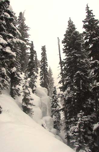
We tromped across the road and donned our 'shoes. The climb under the powerlines probably gave us some horrible disease, but at least we didn't have to walk along the freeway. Our plan was to join the road at a switchback, but by the time we got there we were already several hundred vertical feet above the road. Why give up precious elevation?
We did have to jump across several creeks, but eventually found the real trail. No one else had been up before us so we were blazing our own trail. The quality of the snow ranged from crunchy ice to 10 inches of fresh powder so leading was alternately fine and a chore.
The trail was primarily a series of switchbacks up the spine of the ridge. In four hours we had made about five miles and climbed 3,000 feet to 5,100 feet. Unfortunately, the lake was at just over 5,000 feet so we were clearly not where we wanted to be. Turns out we should have abandoned the spine and stayed lower. By this time it was almost 1:30pm which was our turnaround point. We'd gained too much elevation and were still about a half mile from the lake.
Reluctantly we turned around to head back down the hill. The bonus was that since we knew it was primarily switchbacks we could cut them and basically run straight down the hill. We slid a lot and fell a lot (or at least I did), but the best time was running down the more powdery slopes as mini-avalanches formed around our feet. Now before you get all worried, these were harmless, short slopes with trees interspersed. There was no danger, just fun.
We did wind up having to walk back along the highway which was lousy. The shoulder wasn't big enough to allow us to walk on the pavement safely so we kept our snowshoes on and walked on the residue of the plows. The snow was dirty and soft, but the worst part was the smell of exhaust as trucks roared past us.
By the time we got back to the car (only an hour and 20 minutes from the top) we'd gained and lost 3,000 feet and hiked over nine miles. Without the closure of seeing the lake, though, Merritt Lake remains on my to-do list for future outings.