When we were planning the trip out East we tossed around a bunch of ideas. Acadia was too far. So was Mt. Washington (high point of New Hampshire). Ditching the wedding and going to Mexico would get us in too much trouble. But Vermont seemed like a good idea.
I paged through the peaks in southern Vermont (eerily similar to the Carolinas if White Christmas is to be believed) and landed on Mount Killington. At 7.5 miles and about 2,400 feet of gain from the non-resort side it was right in the sweet spot for a new early morning hike. We had yet more National Parks to visit later in the day so I got an early start even though my body was really, really confused as to what time it was.
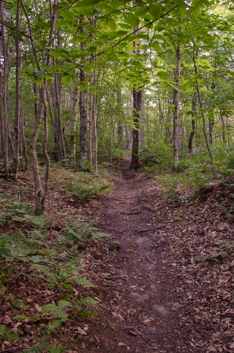
The Bucklin Trail starts at Brewer's Corner because everything has to start somewhere and every somewhere in Vermont is named. (I wonder if Mr. Bucklin was a brewer of beer...) The first part of the trail is almost completely flat. It follows Brewers Brook and crosses it a couple of times on big bridges.
This section is the type of forest I associate with the East. Almost entirely deciduous, several seasons of leaf litter on the ground, and spindly saplings scattered among the more mature trees. So different than the West Coast and so beautiful. (My pictures really don't capture what I saw so just imagine it.)
After the second creek crossing the trail finally starts to climb. It's steeper than a West Coast Forest Service trail, but not nearly as steep as Mailbox. It was a steady grade and straight with no big features to detour around. Kind of like a two-lane highway in the desert. You just go.
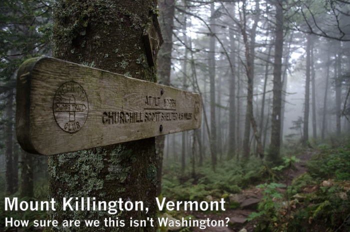
As the trail gains elevation it changes from the deciduous forest down along the creek to more of an evergreen forest. By the time I joined the Appalachian/Long Trail near the Cooper Lodge the terrain was very familiar. It had also gotten chilly now that I was in the clouds. From the lodge, where there was one tent outside, it's only another 0.2 miles on a spur trail to the summit.
Although the Bucklin Trail wasn't quite Mailbox steep this section definitely was. Even better, portions of it were just a jumble of rocks. It wasn't traditional talus like I'm used to, but the experience was very similar. A little unstable and slick in the heavy mist.
At the summit the views were just like you'd expect on a peak west of the crest in the Cascades in November. It turns out the inside of a cloud in Vermont is nearly identical to the inside of a cloud in Washington. When the wind started blowing it felt just like home.
The way down was uneventful except the usual fun of climbing down a talus field and trying not to get onto autopilot. I made a stop at Brewers Brook where the creek spilled through a series of pretty little waterfalls and into a nice pool. Had it been warmer I might have even dipped.
I was back at the car and on the way to find coffee at about the same time the rest of the family was headed into breakfast at the Killington Mountain Lodge.
And if you're wondering, we stayed two nights at the Killington Mountain Lodge. Even though it was mid-renovation it was a good place to stay with easy access to the resort area and the main road, friendly staff, and a great breakfast. It was a bit spooky to be there off-season, though. I felt like we were the only people in the hotel. I bet it's a blast during winter. Maybe we'll have to come back and snowshoe to the summit.