Sometimes doing the unexpected brings the greatest rewards. On a Saturday night the expected move would have been to head up Mailbox or Si. They're close and would serve to get the blood pumping as well as anything. The weather wasn't looking great anywhere, but it was especially nasty near the crest so it was expected we'd stay in the lowlands or maybe go west to try to dodge the coming storms.
Rather than do the expected, though, Eric and I (and Treen, of course) chose to head up to the Pass for a Cave Ridge/Guye Peak double-header. When we pulled into the lot at 6pm hikers were streaming from the trailhead back to their cars. They looked worn after a day at Snow Lake or beyond. We got more than a few funny looks not only as we geared up and left car, but shied away from the maintained trail and opted for the rough old road.
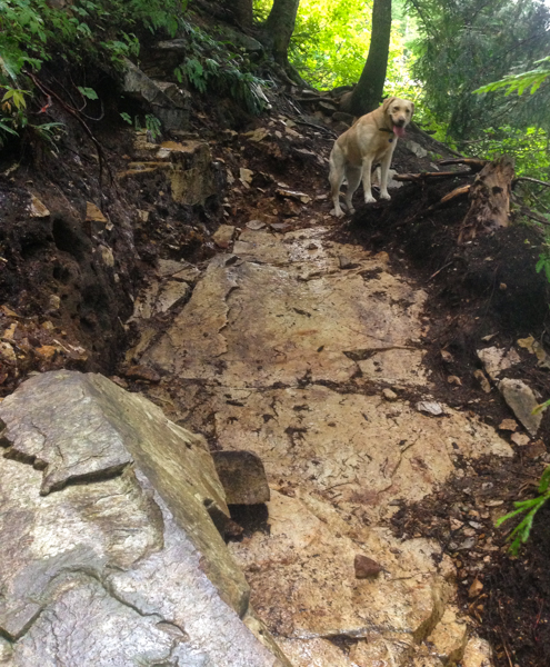
The unofficial trail we took heads steeply up. I know I say Mailbox is steep at 1,600 feet per mile, but this trail, followed all the way to the Snoqualmie Mountain summit, is 2,000 feet per mile. The best parts are just steep trail. The worst are a (sometimes) dry stream bed full of sharp, shifting rocks overhung with devil's club.
Somehow, Treen and I made great time to the first split in the trail. Eric was behind us a ways, giving time to harvest some berries and capture (on (digital) film) a pika for SCIENCE. The usually raging waterfall was bone dry in spite of the heavy rains of the last few days. We abandoned the trail to Snoqualmie Mountain and picked our way into the tight valley between Snoqualmie and Cave Ridge.
Out of the trees, we were treated to open slopes covered with heather and rock as the clouds blew through. It's called Cave Ridge for good reason. Some of the caves are little more than tiny cracks, but a handful are big enough to get into and deep. Enough people make the mistake to go into the caves unprepared that there are emergency kits at the bottom. We chose to stay on the surface.
The dry creek we followed winds northeast around the "back" side of Cave Ridge. We crested the ridge as the sunset silhouetted the peaks to the west against an orange background. The show lasted for only a few minutes after we got our views. I felt amazingly lucky that we'd made it in time.
We again defied expectations and didn't return the way we'd come. As awesome as the valley was, it would soon be too dark to enjoy. Instead, we followed our usual route up down to the saddle between Cave Ridge and Guye Peak.
While Cave Ridge is a large, rounded peak Cave Ridge is a dramatic pillar of rock. Except the route we'd take, it was a technical climb. In the dark, the trail was steep and slick. At the summit, there was little to see beyond the curl of I-90 crossing the Cascades and the occasional flash of a headlamp in the Commonwealth Basin far below us.
This time we did return the way we had come because there really wasn't any other option. The trail down crossed more rocks than Treen was happy with, but soon we were back at the car where she was able to curl up on the back seat.
Like the previous weekend when we had opted for Mt. Defiance instead of Mailbox Peak, we were richly rewarded for taking an alternate path. The rut that had me trudging up Mailbox for the last year and a half seems to be getting shallower with each trip. If this keeps up, it might start affecting the rest of my life. And that's probably not a bad thing.