With another TNAB not happening (for me) I felt the itch to hit the trail. Most of the usual suspects were suspiciously silent when talking about a destination so it fell to me and Eric to choose where we would go. He had recently been to Lake Philippa and assured me it would be a good trip. I'd even seen some pictures showing the area so, sure, why not? So what it if it starts in the Hancock tree farm? Roads make for easy walking. Maybe I'd even come back with the kids or Grandpa Jack. There were supposed to be fish up there...
It wound up being four of us: Scott and Josie were at the parking lot in Snoqualmie when I arrived. I felt terribly out of place in a fancy shirt and silly pants, straight off the bus. We piled into their truck for the hour drive up the North Fork road. This trip didn't require a Hancock permit so the road was worse than other trips in the area, but not too terrible. Being a public road we encountered a few other trucks with gun racks and beer kegs. Standard fare in the tree farm.
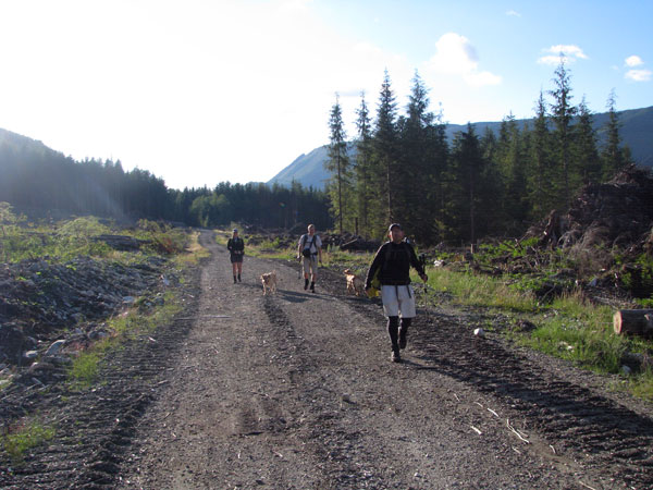
After a quick change at the trailhead (Avert thy gaze, Josie!) we were wandering up the pretty well maintained logging road. With bikes we'd have made quick work of it, but on foot it dragged on. The sky was surprisingly clear in spite of the forecast. Perhaps a peak bagging trip would have been more appropriate. Too late now. We left the clear cut and the road soon degraded to a single track through new growth. Then abruptly it changed to a fisherman's trail through the woods. Eric claimed this was the border of the Alpine Lakes Wilderness, which I disputed heartily. Clearly, this wasn't in the wilderness. How foolish! (After looking at a map of the ALW, um, oops.) The trail was generally easy to follow. In some places it was so well signed it felt like an East Coast trail, but of course there were the occasional, "Which way did it go?" moments.
Eric had mentioned that it was required everyone take a fall and draw blood. Luckily, no (serious) blood was spilled to the creek crossing. A waterfall in a tight gorge was just upstream, but in spite of my best, hurried efforts I couldn't get a good look at it. It definitely deserves a return visit. The log crossing was a tad slick, but not too sketchy. Heck, the dogs did it and they have twice as many opportunities to slip.
So far, we'd had a nice walk in the woods. A little bit of gain, but generally just marveling at the big trees and the views across the valley. Now we were to do some climbing. Straight up. Some spots were only passable thanks to veggie belays allowing us to trust in the roots of blueberries and ferns to hold tight. The "trail" climbed slick slabs of rock with only thin roots providing traction. Thankfully, it'd been dry for a few days or this would have been a complete disaster instead of a mild disaster. The dogs needed a little bit of pushing and pulling, but the rest of us did fine. (Hmm.. what about the way down... in the dark?)
Each time we'd get to the top of a little section Eric would assure us it was the worst and the talus field was just around the corner and the lake just beyond. Uh huh. Oh, yeah. There was that part, too. But after this... Uh huh.
Eventually, we did find the talus field. Eric regaled us with tales of bushwhacking through the head-high brush with his nine year old daughter for an overnight. And you thought I was crazy. Half way across the talus we thought about turning around.
A smart hiker knows his limits. A smart hiker looks at the clock, knows when it will get dark, knows that the lake will be there next year, and knows that going down in the dark isn't going to be fun. A smart hiker turns around on the talus field. Good thing we ain'ts so smarts.
I was encouraged to race ahead to the lake. I think the others were just bored with me, but off I went. There were a couple of blowdowns and multiple trails, but 10 minutes from the talus field I was at the lake.
It's a pretty lake, I think. It was too dark to really tell. Apparently, it's the westmost lake in the ALW and in spite of the trail seldom visited by hikers. Most are probably dissuaded by the tree farm approach and the steep climb. It took about 2:15 to get to the lake, but given the lateness of the season and the drive to the trailhead it was just about to be really dark. I signed the register (at a lake?) and was about to turn back when Eric showed up. Then Scott and Josie. We lingered for a bit preparing for the trip down before taking off.
As lousy as it was going up you'd think it'd be an exercise in death defiance going down. It really wasn't that bad. Don't get me wrong, we definitely should have turned back earlier, but with a few prudent sitting glissades down slippery rocks it wasn't long before we were back at the creek crossing and beginning the long march out. The only problems arose when there were a few unwise grabs at devil's clubs (they don't take kindly to being touched) and of course one or two mistaken turns where a blowdown had obliterated the trail.
We were back at the car in about the same time it took to get to the lake. There was no after-trip meal for me so I headed home right away. A week later I finally got the last of the devil's club thorns out of my hand.
I don't think I'll head back to Philippa any time soon. However, there are supposed to be a couple other lakes up there that must surely be easier to get to...
Totals: 6.8 miles and about 2,500 feet of gain.