Look out! Here comes the White Wall of Death. We're doomed! (No, I didn't make that up. I'm not that clever. Apparently, it was a slow news day.)
Well, crud. After the WWoD died somewhere else leaving the lowlands with no snow it seemed the only logical thing to do was to go where there was supposed to be some snow. Finally, at the lowly 3,000 feet of Snoqualmie Pass the forecast called for buckets of the freshiez and with the biggest full moon since 1993 due I conned a few folks into heading out late.
I met Scott, Jo, and Rich at Trucktown at about 6. Tokul and gear went with Scott and Jo (and Athena and Zeus) while I rode up with Rich, Hoku, and Kami. The dogs were pretty excited in our car, but apparently the three in the other truck were really subdued. It must be my personality.
In the parking lot we found about six inches of snow. A security guard in his truck slowed down a little as he drove past, but didn't stop. With a fair amount of care and luck we survived the most treacherous part of the trip walking along the icy road under the freeway to the actual trailhead. Someone with big tires had driven up to the the trailhead and they were clearly going to be the last driver to go that way until Spring. The snow was almost a foot deep as we walked up the road to find the trail.
The snow and wind didn't grant us much of a respite even when we were in the trees. We certainly couldn't see the moon, but with snow to reflect our headlamps (finally!) we had little trouble following the trail up the valley. As I pushed through the heavily laden branches they released their snow and stood upright. After a while it dawned on me that I should knock the snow off with my poles rather than my head so it got a little more enjoyable after that.
We still didn't have snowshoes on and that was a good thing as we got to the first creek crossing. There was enough water we couldn't easily just walk across, but not so much as to be dangerous. Only the dogs got wet when they decided not to try to hop the rocks across.
We had no trail on the other side so we bushwacked in the general direction we wanted to go and found the trail again. Hurrah! We followed it until we had to cross another creek and then promptly lost the trail on the other side. Dang. But there it was again! And with switchbacks. Wow, I didn't realize this would be as well defined as it was. Of course, everybody else knew we were on the abandoned Commonwealth Basin trail and when we reached a signed intersection nobody else was surprised.
Our rather lofty goal was Cave Ridge so it was time to leave the trail for the climb. We left the convenience of the smooth tread and started picking our way through the half-buried undergrowth. It wasn't easy or straightforward. In fact, it was almost circular. That's why we wound up back on the trail. Hmph. That makes two times out with Scott and Jo where I've actually or nearly gone in a circle. Not a good sign.
We gave up on Cave Ridge at that point and chose to just follow the trail up until about 9pm. At 8:40 we got to a tricky creek/log crossing and decided we'd done enough. We retreated to a clearing and opened our packs for snacks and hot toddies. Rich and Jo accepted cups of hot chocolate (Jo's cup was pink courtesy of the girls) to base their drinks on, but Scott's such a man he went straight for the Schnapps and drank it right from the sippy cup.
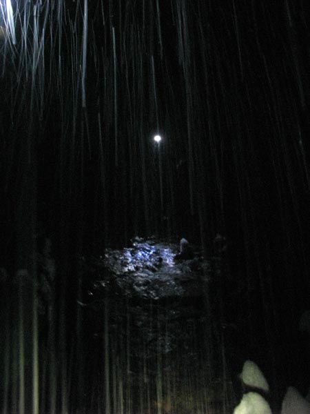
It was snowing heavily making photos with a flash hard and my fingers were getting really cold making any kind of photography difficult so we packed it up and headed out. We had marked our way in in a variety of ways and one even worked to remind us to turn off the trail in the right spot to find our creek crossing.
As we exited into the parking lot of the trailhead we could see the moon trying to burn through the clouds, but with little success. After a few last pictures we descended to the road and the trucks. We tried to go to the Pour House, but it was standing room only so we opted to just head home.
Total distance was about 5.5 miles and just short of 1,000 feet of gain.
And of course, Tokul lost her collar. Again. Full of her tags and licenses. Again. But this time it was actually discovered by a Forest Service volunteer. Hurray!