After a very mellow hike to Clara Lake the day before I was itching to get in some real work on the trail. In fact, it'd been a few weeks since I'd been made to really sweat on a hike. Granted, packing in an entire campsite to Margaret Lake had been no walk in the park, but it wasn't like the TNAB trips I'm missing.
Although this weekend had originally held the promise of a multi-mile hike into the Sawtooths with Martin that had been foiled by responsibility. Instead, I decided to get up in the dark to climb Chelan Butte just outside town.
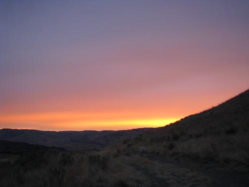
My alarm went off at six and I dragged Tokul from her comfy bed and into the surprisingly moderate morning chill outside. The day before had been almost below freezing for the entire hike, but this time the temps were around 45 with occasional very light rain as I sat in the car with a mocha waiting for the sky to brighten enough to prevent total disaster.
Even once it was light I wasn't sure we were on the right trail. It was more an overgrown road and altnough it appeared to start in a dusty parking lot there was only one set of prints in the dust. GPS showed we were exactly where we should be, but that was based on a somewhat suspect line on the map. Nonetheless, we pushed up.
Where the road tended left there was a boot path through the grass that went right around a knob of rock. Surely, this must be the way. Except the path disappeared under sagebrush and tumbleweeds. Ah, well, GPS showed the trail was to our left so we climbed with a tendency toward that side. We picked up another path and then that ran out. However, this time I could see a more significant trail ahead so we pushed on.
As we crested a little rise I saw a coyote briefly look at us and then spring over the brush and out of sight. Had I not been sure that Nicole's dog, Bacchus, was at home I'd swear it was him. Each time we gained another hill there was another. All along there was a single track heading up with no hint of a switchback or an opportunity to so much as catch your breath without having to lean into the hillside.
Bits of old cable were strewn about and for the upper section there was a continuous thick black cable running up the hill. On Tiger Mountain there's a route called the Cable Line trail that takes almost the same no nonsense approach. I don't know that I'd have chosen this trail had I known it was going to be the same.
Finally, finally we reached the ridgeline. Looking back down I was amazed we'd actually climbed straight up. I wasn't looking forward to the descent. I could see what was clearly the real trail easing up the ridge's crest (and in fact we had crossed it lower down). The ridge trail continued along the long ridge into the trees, and to the summit.
We had great views down to the Columbia on one side and Lake Chelan on the other. Unfortunately, the blue bird skies of the day before were gone replaced by thick clouds that continued to drop occasional rain on us, but never enough to justify putting on even so much as a fleece. (I had stowed my fleece on the way up and was in just a t-shirt.)
As we got closer to the summit I saw big bags of chalky powder split open along the trail. Suddenly, it dawned on me that the class names and numbers spelled out on steep slopes aren't made up of white rocks, but presumably lighter powder that occasionally spilled out. (Looking at Chelan Butte through Google maps or MapQuest you can see the numbers quite clearly.)
At the summit we were surrounded by radio towers so Tokul and I did little more than have a drink before turning for home. I figured it was an hour and a half to get up so perhaps an hour to get down. Along the way I saw the bums of a pair of mule deer (I think) bound away down an impossibly steep slope. It was so steep I couldn't even get a good view of where they went.
At the top of the cable line I looked at the time. It'd been half an hour to get this far. We had about 1,000 feet of elevation to drop over about half a mile. Too bad there was no snow.
However, before we could get going too much I saw movement on a parallel line to the right. Mr. Coyote was loping through the brush. He must have seen us because he (um... I assume it was a "he," but for no good reason) stopped and looked right at us. I zoomed in as much as I could and snapped off a dozen or so shots hoping something would turn out.
Back to the hill.
On the climb up I had kicked steps into the soft dirt and cursed the loose stuff that contributed to the whole two steps up one step back problem. On the way down, though, I could step quickly and slide a foot with each stride. It's the same sort of step you'd use in soft snow or on scree. It made the descent fly by, but by the time we were down on the level road below my thighs were screaming and poor Tokul was lagging behind.
Still... 15 minutes to drop to the car. Sweet.
Total distance was about five miles and 2,500 feet of gain. Unfortunately, Chelan Butte didn't really do that much for me. It's a great, close-to-town exercise option, but that's about it.
Unless the coyote turns out to actually be a wolf. The jury's still out on that one. We'll see if this doesn't become a really neat trip after all.