Chris is a hiker I met through TNAB. We had planned a three day ascent of Mt. Adams, but all that glorious snow I was loving all winter long has turned on me. The Mt. Adams trailhead is a solid 12 miles from the end of the road. We looked at Mt. Baker, but the road was blocked four miles short of the trailhead. Mt. St. Helens was blocked about eight miles away from the climber's start.
So now what? We considered a multi-day trip in the Middle Fork, but opted instead for a one-day trip up the old Pratt River trail and a bushwhack up Russian Butte. After Mt. Washington just a few days before it was pretty unlikely we'd be successful, but at least we'd give it a shot.
We started at 5am and by 6am we were parked along the Middle Fork road blowing up the raft. Yeah, seriously. A raft. The plan was to raft across the Middle Fork to just upstream of the mouth of the Pratt River. If we were lucky we'd find the old trail that is shown on some maps, but is hardly ever visited.
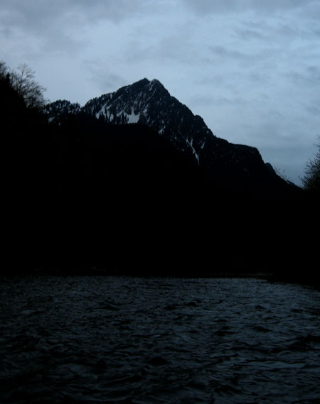
The ride downstream was pretty uneventful and gave us some great views of Russian Butte. It looked awfully, awfully tall. Especially without a trail leading us up. We found a spot on the high bank and fought our way up the loose nastiness. We stashed the boat and waders in the trees and followed a flagged path along the shore.
Just downstream from where we landed the trail turned away from the Middle Fork and paralleled the Pratt. The trail is barely a scratch, but easy to follow. There had been a bunch of work on the trail clearing trees and flags marking what looked to be remnants of the old road. We figured it was all part of Senator Reichert's plan to expand the Alpine Lakes Wilderness and designate the Pratt a Wild and Scenic River. Regardless, we made good time.
The trail split where there's a shattered sign propped against a tree. To the right were supposed to be "Big Trees" and to the left the trail was "maintained." Even though we'd have to lose the elevation gained by going to the left we switchbacked up the hill. (The sign looked to be of the same type as shown in the bottom, center picture on midforc.org.)
After crossing a couple of small creeks we left the trail and headed down the hill. There was virtually no undergrowth in the forest so aside from slipping on rotting trees we had little to stand in our way. Stumps of huge trees that were logged years ago litter the area making me wonder what it would have been like to see the giants.
We found a road lower on the slope and followed it a short distance before it ended at the Pratt. The plan called for us to find a way to ford the river without getting wet, but that was looking unlikely. The river was tightly confined so it ran fast, but never so tight that you could hop rocks across.
After about a quarter mile of searching upstream we found what was likely our best spot. Three rocks led from the shore to a large boulder in the middle of the river. A tree was wedged against the rock and led to the other side. Chris easily crossed to the center rock and then waited for me to cross. And waited. And then waited some more. He cheered the way I cheer on the kids when they do something they aren't fond of. Happily, I made it without incident.
I turned my back to mess with my poles while Chris started inching his way across the log. When I looked back he was sideways and slowly rotating the wrong way. With his pack on it was clear he wasn't going to recover so he let his legs go and then dropped off the log into the river. Amazingly, he popped up on to the other side of the boulder without much effort, but clearly shocked and cold from the snowmelt swollen river.
We retreated to our side of the river so he could change into what clothing he had that wasn't soaked. He wasn't in the water long, but he was wet enough it was clear we couldn't continue up. I was just relieved I didn't have to try to cross the log.
We ate a quick lunch... at 9am... and poked along the shore upstream a bit looking for a better place to cross, but found nothing. Clearly crossing the Pratt needed to be done either with less water or a more realistic expectation about getting wet.
We decided to follow the low road out hoping it would lead us past the big trees, but we never did see them. We joined the main trail and were back at the raft in no time. Chris rowed us downstream to the takeout where I jumped out to manhandle the raft onto the shore. (Waders are so handy.) We left the raft on the side of the road and walked about a quarter mile back to the car.
Even though we didn't even get to the other shore of the Pratt it was a good trip if only for the scouting opportunity. I'd always wanted to look at the Pratt trail and now I think I'll try to find a time when I can hike it all the way to the source at Pratt Lake. It'd be realistic if only a connection could be made to the bridge at the Middle Fork gateway trailhead.
We managed six miles and 1,000 feet of gain and as a bonus I was home early enough I could get cleaned up and get to wine club. Now it's just time to schedule a return...