After Washington, D.C., you'd be forgiven if you thought we would be done with history. However, you fail to realize the very depths of our love of history. (You know the first meeting of the Moosefish was in a WWI history class, right?) So no. Not done with history or National Parks. And finally, we're not done with hiking either.
Harpers Ferry is a historic town at the junction of the Potomac and Shenandoah Rivers. The rivers don't come together at a nice 90 degree angle. Nope. They come to a point right off the piece of land called, "The Point."
Sitting at the junction of two important rivers, Harpers Ferry was the site of... you guessed it... a ferry. Bridges were built for the railroad in 1836 and the town became even more prosperous. It was the the location of John Brown's raid in 1859 and during the Civil War the town changed hands repeatedly. The bridges were destroyed and rebuilt at least nine times.
Much of the town is now part of the Harpers Ferry National Historical Park. It's also home to the Appalachian Trail Conservancy so it's no wonder we experienced the Park on the trail.
It wasn't the first time we'd been on the AT. As a family we "hiked" it to the high point of Massachusetts and I had early mornings on the Long Trail climbing Mount Killington and Stratton Mountain. This part of the AT wasn't going to be quite as adventurous, though.
The Park offers walking tours led by a ranger that starts in the upper town at the Mather Training Center. Oh, didn't I mention all the interpretative rangers for the NPS get trained at Harpers Ferry? Crazy, huh?
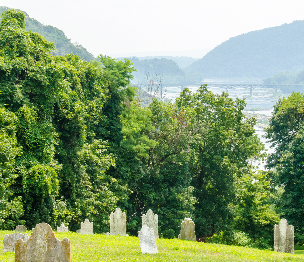
We walked down the streets (CAR! CAR! Game on!) and through the Harper Cemetery past graves reaching back two hundred years. Just down the hill (and some sporty steps) the AT ran through the trees past Jefferson Rock (yeah, he stood there once) and down into the lower town. Along the way the ranger gave us the history scoop and pointed out the best place to get a scoop of ice cream, which may have been the most valuable piece of information shared all day given it was at least 1,000 degrees.
That wasn't nearly enough hiking, though. The smarter portion of our group (i.e., everyone, but me) wrapped it up after the kids got their Junior Ranger badges and headed back to the hotel. I hopped on the AT again and crossed the Potomac into Maryland. Another state? Well, yeah, duh. I was hiking up Maryland Heights. It wouldn't do for that to be in West Virginia.
Maryland Heights is a high ridge more than 1,000 feet above the rivers. Clearly, whoever held the ridge would have an advantage in a Civil War era battle. The Union built trenches, camps, and a big stone fort, but they were never attacked and the fort was eventually turned into a storehouse.
The trails are mostly old roads with interpretive signs giving the details of each spot. There are multiple routes and I chose the longest that climbs to Stone Fort. I was happy for the excuses to stop and read a sign given the steepness of the road. Of course, I felt less good about my performance when one of the signs pointed out that soldiers climbed the same slope laden with supplies and heavy gear. Still, I love these historical markers. (Many are listed in the sweet Historical Marker Database.)
Higher on the ridge there were no people and the roads dwindled to trails through the typical East Coast open forest. The earthworks and the ruins of the Stone Fort were easy to see and it made the challenge of taking a hill like this real. The idea of climbing 1,000 feet with virtually no cover while people are shooting downhill is terrifying.
Coming down the ridge was fast except for pauses to look at deer and rabbits crossing the trail. It was close to 3pm and the heat and humidity were intense. I tried spraying water on my face, but that didn't help because the water wouldn't evaporate. These are not my favorite conditions.
At the main overlook all of Harpers Ferry is laid out below. The junction of these two big rivers was obviously important. Especially if you zoom the map out to see how much land is accessible through the two drainages.
What I liked most about visiting this Park is the way it integrated history with the living town and geography. Most of the sites we've visited have been one or the other. All history and no nature or all nature and no history. If I had to choose one of those it'd be all nature, of course, but adding history makes it that much more meaningful. Well done, NPS.